US West Coast on fire
Over the past month, dozens of wildfires have burned vast swathes of land in California, Oregon and Washington State, killing more than 30 people and smothering the majority of the western United States in smoke. While photographs have circulated online showing the apocalyptic orange skies, satellites in orbit around Earth carry different instruments that can provide not only images, but a wealth of complementary information needed to monitor the blazes.
Record high temperatures, strong winds and thunderstorms have created the dangerous conditions that have allowed fires in western United States to ignite and spread. Plumes of smoke from the fires are so large, they have travelled across the US, even reaching New York on the east coast. According to the Copernicus Atmosphere Monitoring Service (CAMS), the smoke is forecasted to reach Europe this weekend.

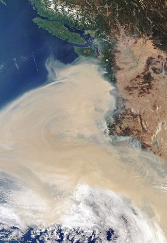
In this spectacular image, captured by the Copernicus Sentinel-3 mission on 16 September, fires can be seen burning on the west coast of the US, with smoke travelling eastwards across the country. Meanwhile, Hurricane Sally is visible making landfall on the east coast. Hurricane Sally hit Gulf Shores in Alabama on Wednesday, with wind speeds of around 169 km/hr recorded, before decreasing into a tropical depression.
While the image above was captured by the mission’s ocean and land colour instrument, which provides camera-like images, the mission’s sea and land surface temperature radiometer instrument records fire hotspots. The instrument works similar to a thermometer – measuring thermal infrared radiation to take the temperature of Earth’s land surfaces.
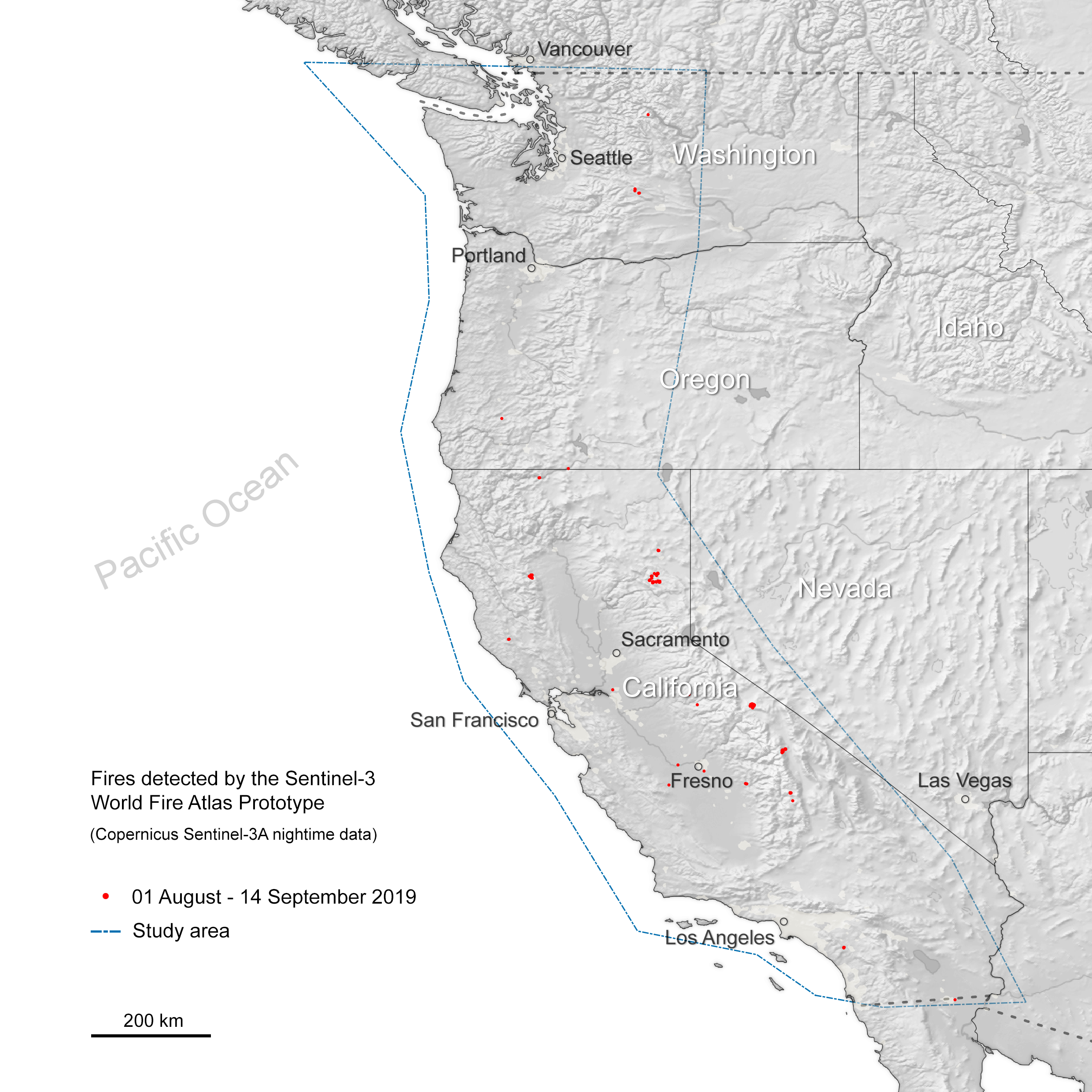
This information is used to detect and monitor the heat emitted by fires. These two dedicated fire channels are used to compile the World Fire Atlas.
The animation shows the number of fire hotspots detected between 1 August—14 September 2019, compared to 1 August—14 September 2020.
These measurements were taken by the Copernicus Sentinel-3A at night only. Comparing fire activity with the previous year, the data suggests that there have been hundreds of more fire hotspots in 2020 compared to the same period last year.

The Copernicus Sentinel-5P satellite, dedicated to monitoring air pollution, has detected the increased concentrations of carbon monoxide along the west coast.
The hotspots visible in the image show the precise locations of the wildfires, which have been identified in bold.
While carbon monoxide is commonly associated with traffic, the increase in concentrations comes from the fires. Once in the air, carbon monoxide can cause problems for humans by reducing the amount of oxygen that can be transported in the bloodstream.
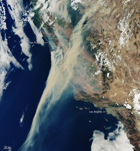
Optical images captured by the Copernicus Sentinel-2 mission have also been used to image the fires. Each of the two satellites carry a high-resolution camera that images Earth’s surface in 13 spectral bands.
The image below, captured on 9 September 2020, shows some of the wildfires over Oregon. The view on the left shows the affected area captured by the camera-like instrument onboard the satellite, while the composite on the right utilises the SWIR bands of the same instrument which penetrate the smoke of the fire, and provide a clearer view of the fire front and affected area at the time of the acquisition.