Craters, lava flows and tectonic features near Ma'adim Vallis
The Mars Express High Resolution Stereo Camera imaged a region close to Ma’adim Vallis, one of the largest canyons on Mars, finding craters, lava flows and tectonic features.
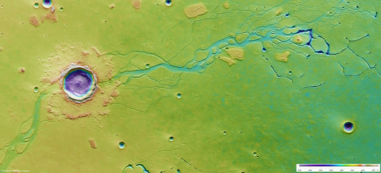
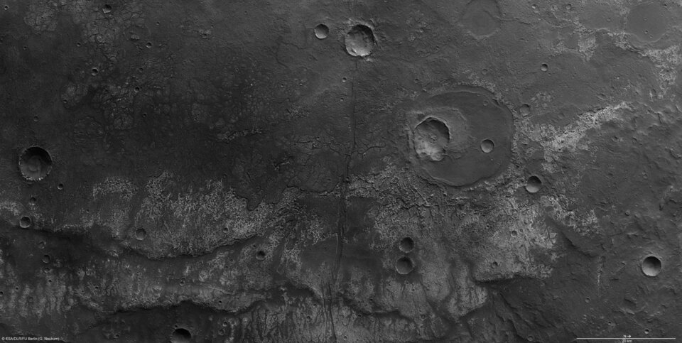
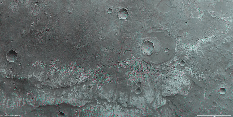
After Valles Marineris, Ma’adim Vallis is one of the largest canyons on Mars. The region, lying south-east of Ma’adim Vallis, was imaged on 24 December 2008. The pictures are centred at about 29°S and 182°E and have a ground resolution of 15 m/pixel.

Ma’adim Vallis is located between the volcanic region of Tharsis, which harbours four volcanoes, including the largest in the Solar System, and the Hellas Planitia impact basin. The canyon, 20 km wide and 2 km deep, originates in the southern highlands close to the ‘dichotomy boundary’ and ends in Gusev crater. The dichotomy boundary is a narrow region separating the cratered highlands, located mostly in the southern hemisphere of Mars, from the northern hemisphere's lowland plains.
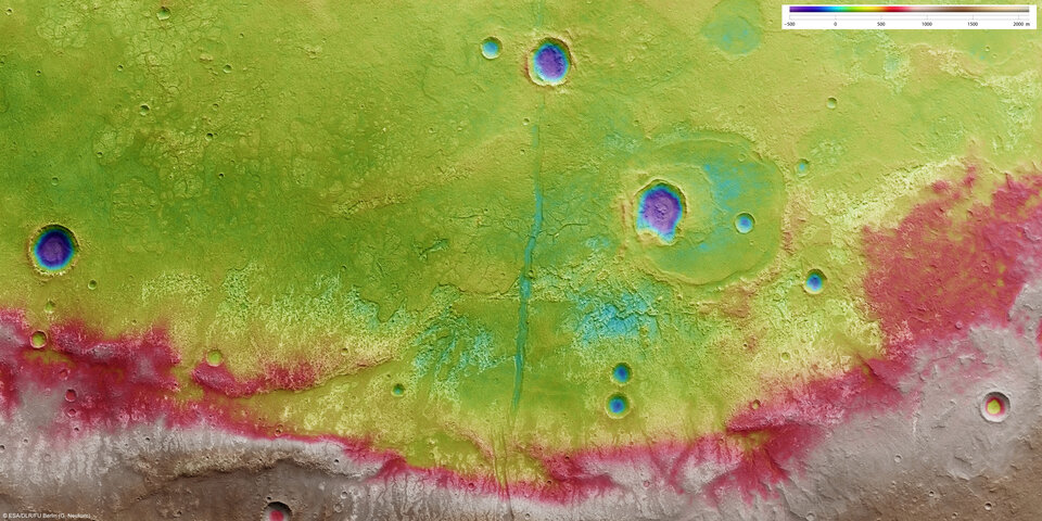
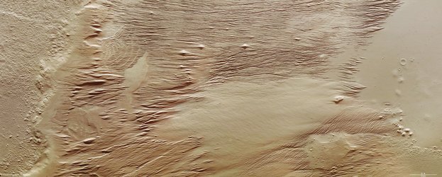
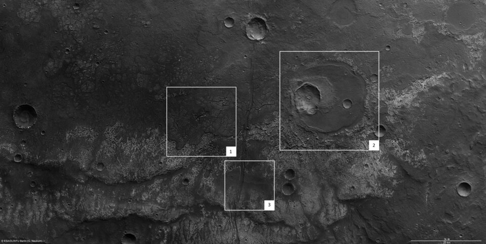
The images cover 138 x 70 km, roughly the size of Cyprus. A sharp boundary is visible in the centre, dividing dark material to the west and light material to the east. Scientists suspect that this feature is most likely the edge of a basaltic lava flow.

Wrinkle ridges are clearly visible on the surface of the lava flow. They were most likely formed by compressive forces.
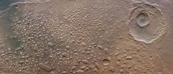
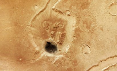
To the north is a crater, almost 20 km in size. It is partially filled with lava, which shows that it must have formed before the lava set in. The smaller, 7 km crater at the southern edge of the larger crater must have formed later because it has an ejecta blanket that may have formed from material rich in water-ice ejected during impact.

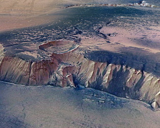
A linear feature, more than 200 km long, divides the image almost in the centre. It is most likely a trough associated with the uprising of the Tharsis volcanic region in the north-east. The uprising may have created a lot of stress in the crust which was released when the fracture zones formed, creating the trough.

The colour scenes have been derived from the three HRSC-colour channels and the nadir channel. The perspective views have been calculated from the digital terrain model derived from the stereo channels. The anaglyph image was calculated from the nadir and one stereo channel. The black and white high-resolution images were derived from the nadir channel, which provides the highest detail of all channels.
For more information on Mars Express HRSC images, please read our updated FAQ (frequently asked questions).