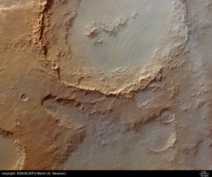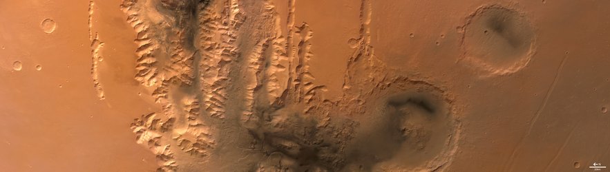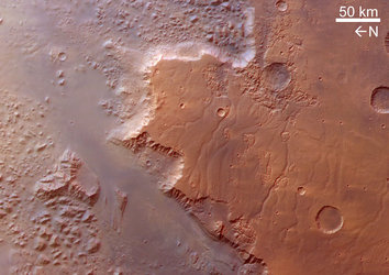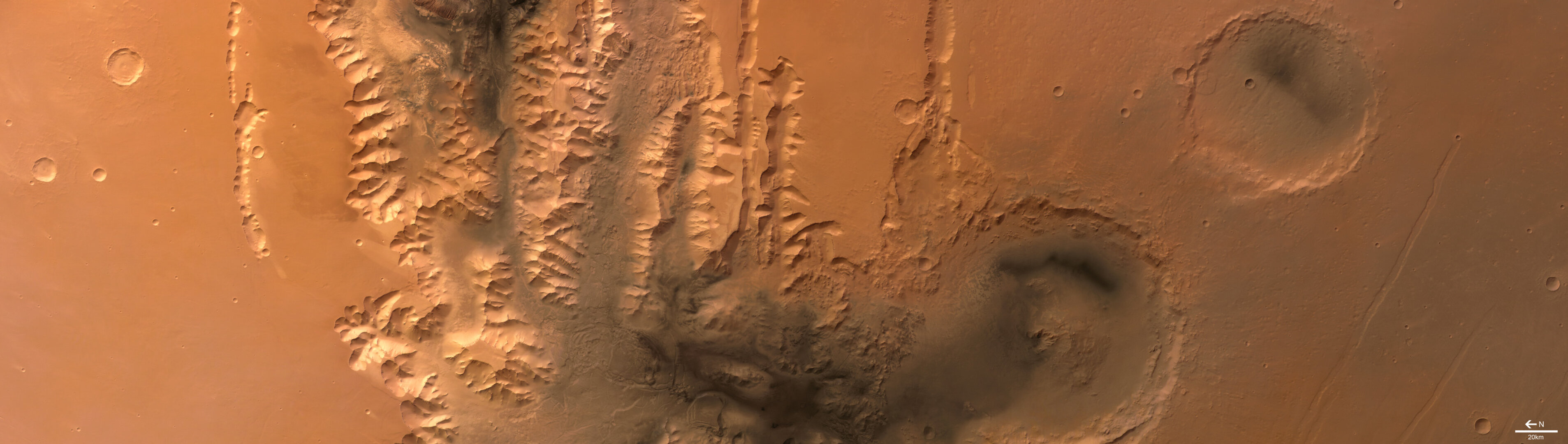
Tithonium Chasma, Valles Marineris, on Mars
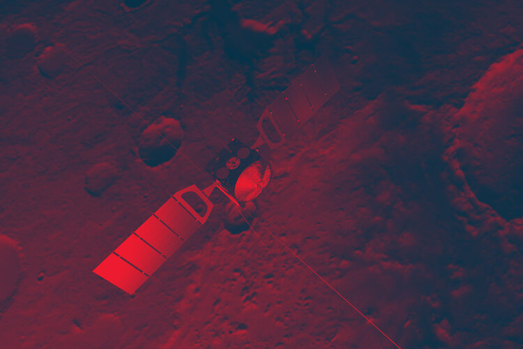
These images, taken by the High Resolution Stereo Camera (HRSC) on board ESA’s Mars Express spacecraft, show the western end of the Valles Marineris Canyon system on Mars.
The images were taken during orbit 442 with a ground resolution of approximately 52 metres per pixel. The displayed region is located at the beginning of the canyon system at about latitude 7° South and longitude 269° East.
The images show the western end of the canyons Tithonium Chasma and Ius Chasma, part of the Valles Marineris canyon system, which are up to 5.5 kilometres deep.
The whole canyon system itself is the result of a variety of geological processes. Probably tectonic rifting, water and wind action, volcanism and glacial activity all have played major roles in its formation and evolution.

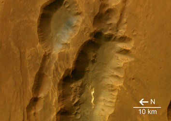
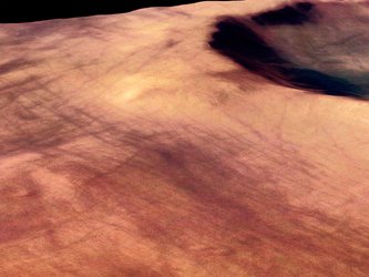
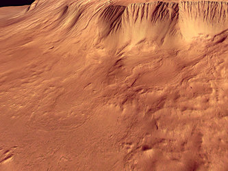
The canyon floors are covered by a dark, layered material, the so-called ‘Interior Layered Deposits’. These deposits are marked by a system of polygonal cracks through which the underlying, lighter-coloured rock can be seen.
The Interior Layered Deposits are still a major topic of research. Parts of the deposits are most probably volcanic, while in other areas a sedimentary origin has been proposed.
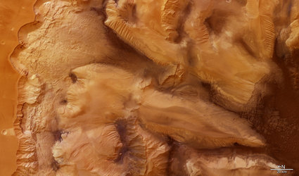
The morphology of the valley flanks has been modified by ‘slumping’ and rockfalls. Slumping is when a substantial part of a mountain, cliff or hill ‘breaks away’ and slides more or less intact to the bottom of the slope.
Some of the major slumps here are more than thirty kilometres wide. The flanks are often covered to a large extent by their own ‘talus’, or rock debris that has fallen from the sides of a cliff or steep slope.
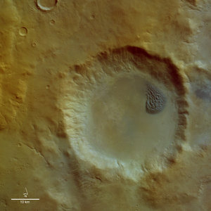
The large, deeply eroded Crater Oudemans in the south of the area (bottom of the image) has a diameter of about 120 kilometres.
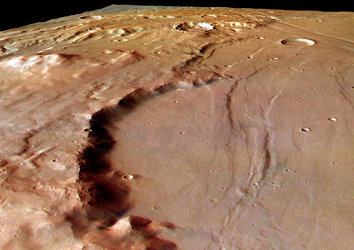
Around the central mount of the crater, large plains composed of dark rock can be seen. These plains are covered by lighter sediments, deposited through the action of the wind. Several systems of tectonic faults can be seen in the imaged area.
The most prominent is the system of Valles Marineris itself, running east-west. South of Crater Oudemans, smaller tectonic ‘grabens’ running from the south-west to the north-east can be seen. To the north of the large canyons, there are more fault systems.
The Valles Marineris region is one of the most studied areas on Mars. The canyon system is one of the major keys to the tectonic and volcanic history of this planet. Research on the sedimentary rocks and the products of erosion can also provide major insights into its climatic evolution.
Due to the stereo capability of the HRSC, the new image data gained can provide new insights into the geology of Mars. This will lead to a new, more precise reconstruction of Martian geological history.
Image resolution has been decreased for use on the internet. The colour images were processed using the nadir (vertical view) and colour channels.
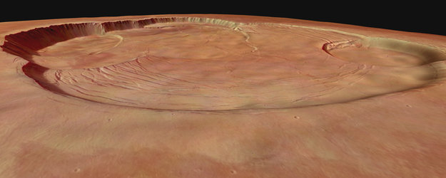
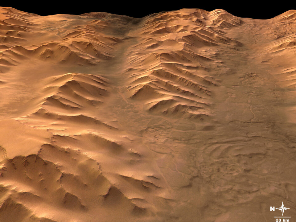
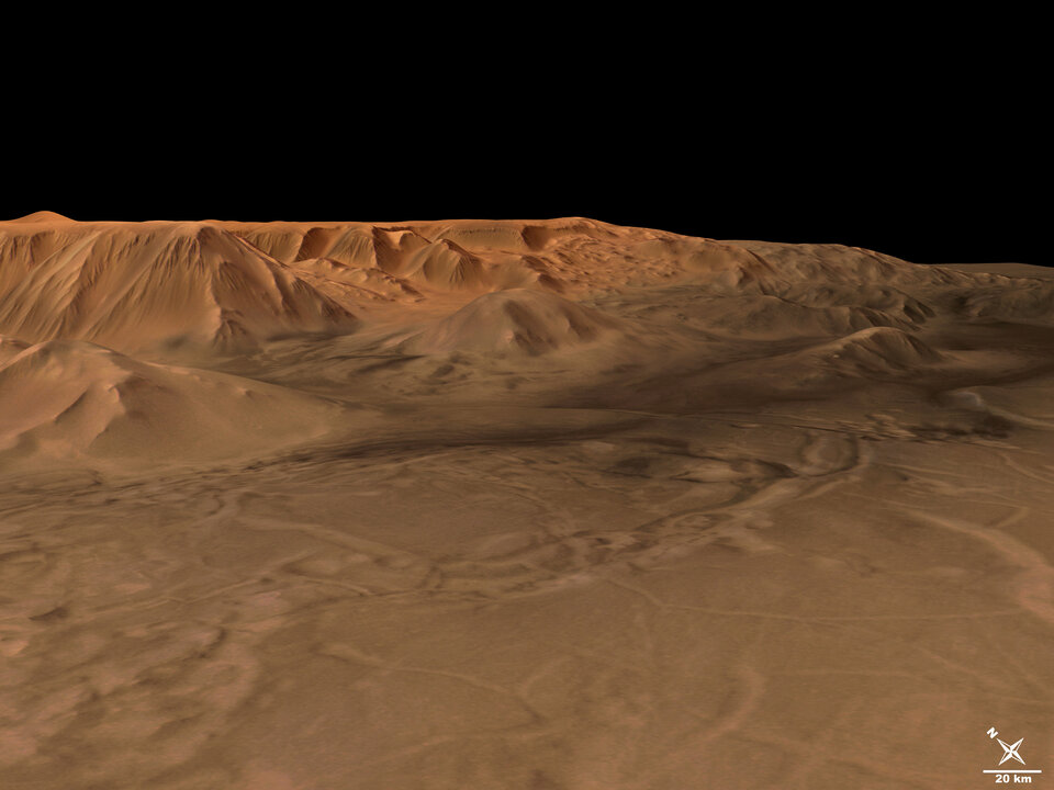
The perspective views were calculated from the digital terrain model derived from the stereo channels.
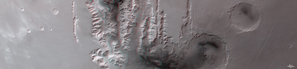
The 3D anaglyph image was created from the nadir channel and one of the stereo channels. Stereoscopic glasses are needed to view the 3D image.
For more information on Mars Express HRSC images, you might like to read our updated 'Frequently Asked Questions'.