Cydonia - the face on Mars
ESA's Mars Express has obtained images of the Cydonia region, site of the famous 'Face on Mars.' The High Resolution Stereo Camera photos include some of the most spectacular views of the Red Planet ever.
After multiple attempts to image the Cydonia region from April 2004 until July 2006 were frustrated by altitude and atmospheric dust and haze, the High Resolution Stereo Camera (HRSC) on board Mars Express finally obtained, on 22 July, a series of images that show the famous 'face' on Mars in unprecedented detail.
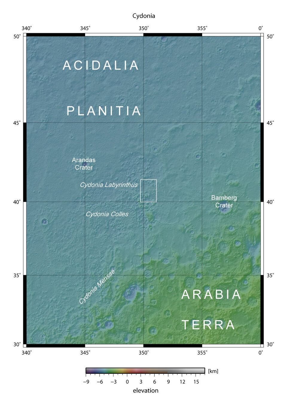
The data were gathered during orbit 3253 over the Cydonia region, with a ground resolution of approximately 13.7 metres per pixel. Cydonia lies at approximately 40.75° North and 350.54° East.
"These images of the Cydonia region on Mars are truly spectacular," said Dr Agustin Chicarro, ESA Mars Express Project Scientist. "They not only provide a completely fresh and detailed view of an area famous to fans of space myths worldwide, but also provide an impressive close-up over an area of great interest for planetary geologists, and show once more the high capability of the Mars Express camera."
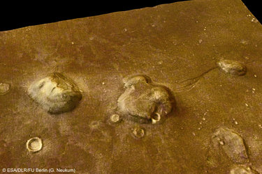
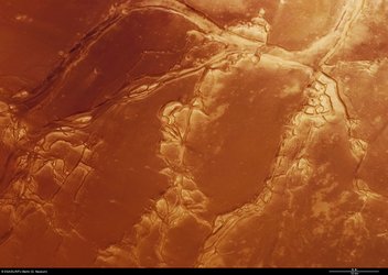
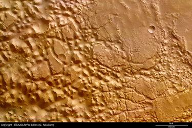
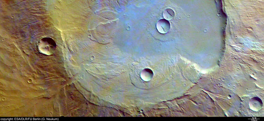
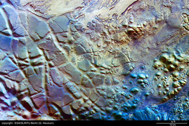
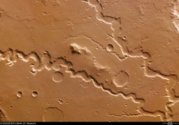
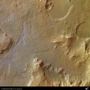
Cydonia is located in the Arabia Terra region on Mars and belongs to the transition zone between the southern highlands and the northern plains of Mars. This transition is characterized by wide, debris-filled valleys and isolated remnant mounds of various shapes and sizes.
'Human face' first seen in 1976
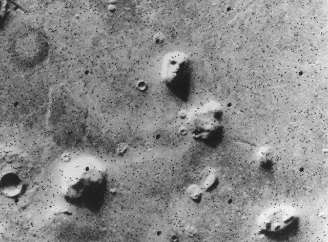
One of these visible remnant massifs became famous as the 'Face on Mars' in an image taken on 25 July 1976 by the American Viking 1 Orbiter.
A few days later, on 31 July 1976, a NASA press release said the formation "resembles a human head." However, NASA scientists had already correctly interpreted the image as an optical illusion caused by the illumination angle of the Sun, the formation's surface morphology and the resulting shadows, giving the impression of eyes, nose and mouth.
Nonetheless, the 'Face on Mars' was the subject of widespread speculation on the possible origins and purpose of artificial structures on the Red Planet, with the face being the most talked-about formation.
The array of nearby structures has been interpreted by some space enthusiasts as artificial landscapes, such as potential pyramids and even a disintegrated city. The idea that the planet might have once been home to intelligent beings has since inspired the imagination of many Mars fans, and has been expressed in numerous, more-or-less serious, newspaper articles as well as in science-fiction literature and on many Web pages.
Despite all this, the formal scientific interpretation has never changed: the face remains a figment of human imagination in a heavily eroded surface.
It took until April 1998, and confirmation with additional data from the Mars Orbiter Camera on NASA's Mars Global Surveyor, before popular speculation waned. More data from the same orbiter in 2001 further confirmed this conclusion.
Significance for planetary geologists
While the formations aren't of alien origin, they are nevertheless of significant interest to planetary geologists.

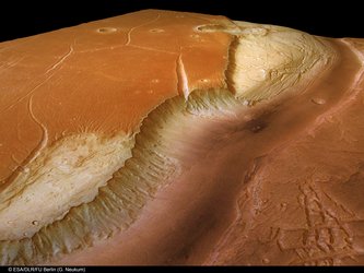
In areas adjacent to Cydonia, gently sloping areas surrounding hills or reliefs, so-called 'debris aprons,' are frequently found. They form at the foot of such remnant mounds and probably consist of a mixture of rocky debris and ice. In Cydonia itself, such aprons are often missing in smaller massifs. The formation of debris aprons is considered to be controlled by talus formation, a sloping mass of rock debris at the base of a cliff, and landslides.
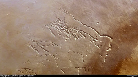
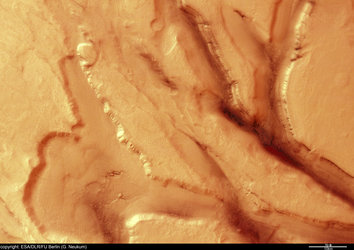
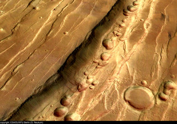
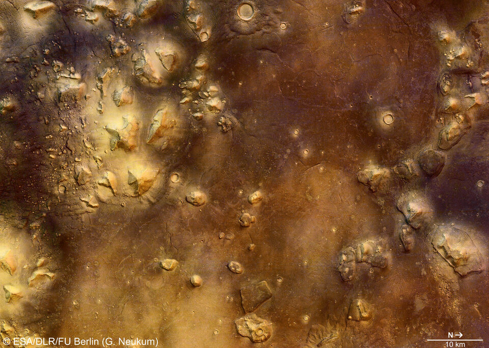
At the Mars 'face,' such characteristic landslides and an early form of debris apron formation can be seen.

Former larger debris aprons might have been covered by later lava flows in the surrounding area; the western wall of the face moved downslope as a coherent mass. The location of the detachment zone is reflected by a large scarp extending from North to South. The results of large mass wasting, or downslope movement of rock, are also visible at the foot of the pyramid-like formations.
Between April 2004 and July 2006, the HRSC gathered data from the Cydonia region numerous times.
However, high flight altitude, resulting in poor data resolution on the ground (orbits 0262, 2533, 2872), as well as dust and haze in the Martian atmosphere, leading to heavily reduced data quality (orbits 1216, 2872) prevented the acquisition of high-quality Cydonia images.
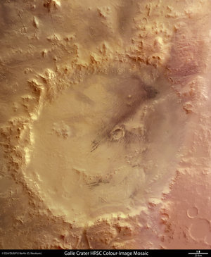
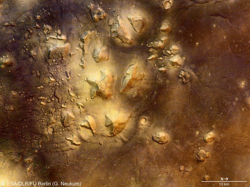
'Skull-shaped' structure appears in some images

In fact, in addition to the well-known 'face' and 'pyramids,' a naturally skull-shaped structure also appears in some of the Mars Express images.
As the famous scientist and writer Carl Sagan said:
"Imagination will often carry us to worlds that never were. But without it we go nowhere." |


Note on images:
The colour scenes were derived from three HRSC-colour channels. The perspective views have been calculated from the digital terrain model derived from the stereo channels.
The 3D anaglyph images (shown in the accompanying article linked at right, above) were derived from the stereo and nadir channels. Image resolution has been decreased for use on the internet.
Note to editors:
The HRSC instrument and science team is led by Principal Investigator Prof. Dr Gerhard Neukum. The team consists of 45 co-investigators from 32 institutions and 10 nations.
The systematic processing of the HRSC image data is carried out by the German Aerospace Center (DLR), while the images shown here were processed by the PI group at the Institute for Geosciences, Freie Universitaet (Free University), Berlin, in cooperation with DLR's Institute of Planetary Research, Berlin.
For more information:
Dr Agustin Chicarro
ESA Mars Express Project Scientist
agustin.chicarro @ esa.int
Gerhard Neukum
HRSC Principal Investigator
Freie Universitaet Berlin
Email: gneukum @ zedat.fu-berlin.de
This article includes several 3D anaglyph as well as other images. Use the link at right above to access these separately.
For more information on Mars Express HRSC images, please read our updated FAQ (frequently asked questions).