Tectonic signatures at Aeolis Mensae
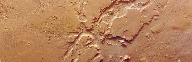
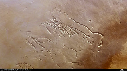
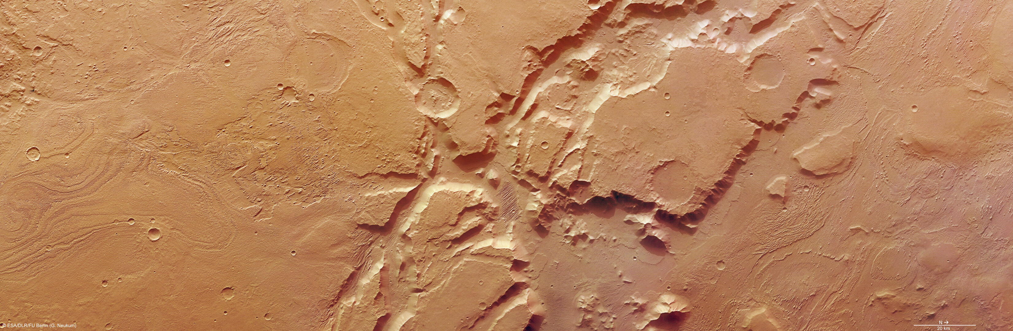
The High Resolution Stereo Camera (HRSC) on board Mars Express has provided snapshots of the Aeolis Mensae region. This area, well known for its wind-eroded features, lies on a tectonic transition zone, characterised by incised valleys and unexplained linear features.
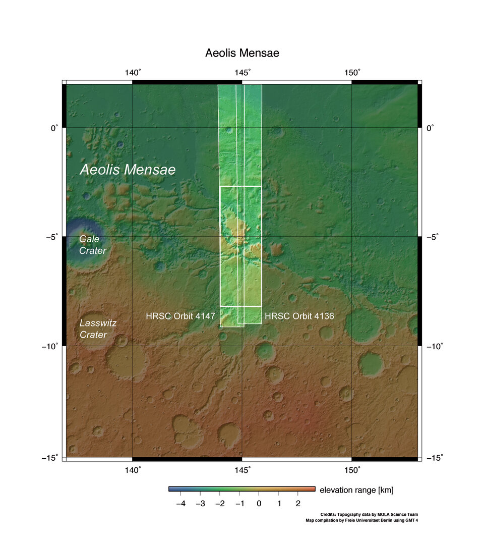
Illuminated by the Sun from the west (right side in the image), the pictures are of a ground resolution of approximately 13 metres per pixel. The region, imaged on 26 and 29 March 2007, during Mars Express orbits 4136 and 4247, is located at approximately 6° South and 145° East.
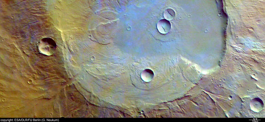
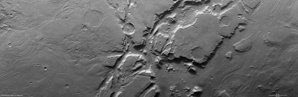
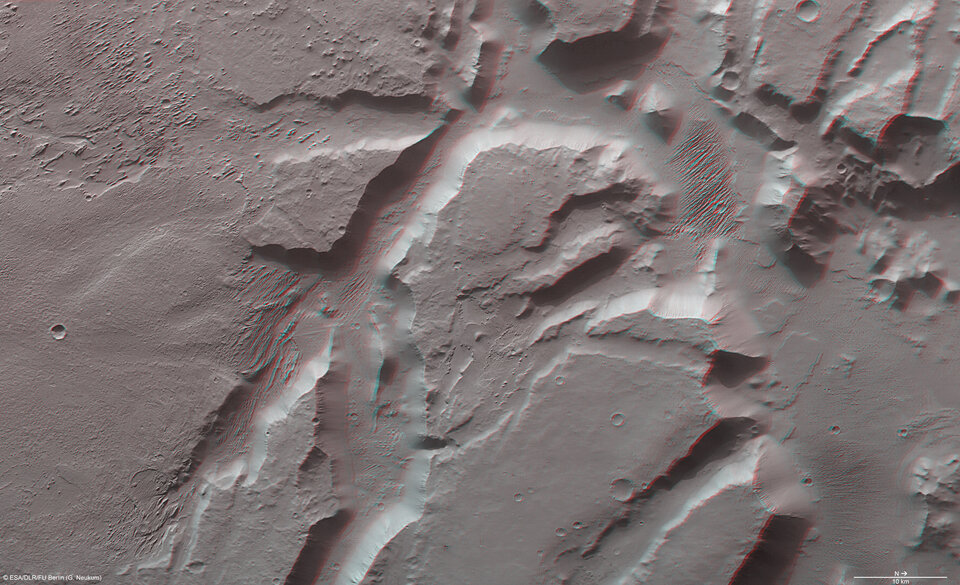
The morphology of the terrain, which lies close to the volcanic region of Elysium, is characterised by an extensive transition zone or the so-called ‘global crustal dichotomy boundary’ which separates the southern highlands and northern lowlands. It exhibits clod-shaped or lumpy relief separated by valleys and graben structures, or elongated, trench-like erosional features.
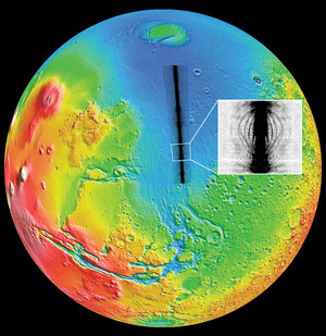
Aeolis Mensae is located at the border between the northern plains and the southern highlands, indicated by the transition zone. The area shown in the image mosaic is part of the southern highlands and the transition zone to the north. Between the highlands and the plains there is a large average difference in elevation, of about 3000 metres. The origin of this dichotomy is currently a subject of discussion.
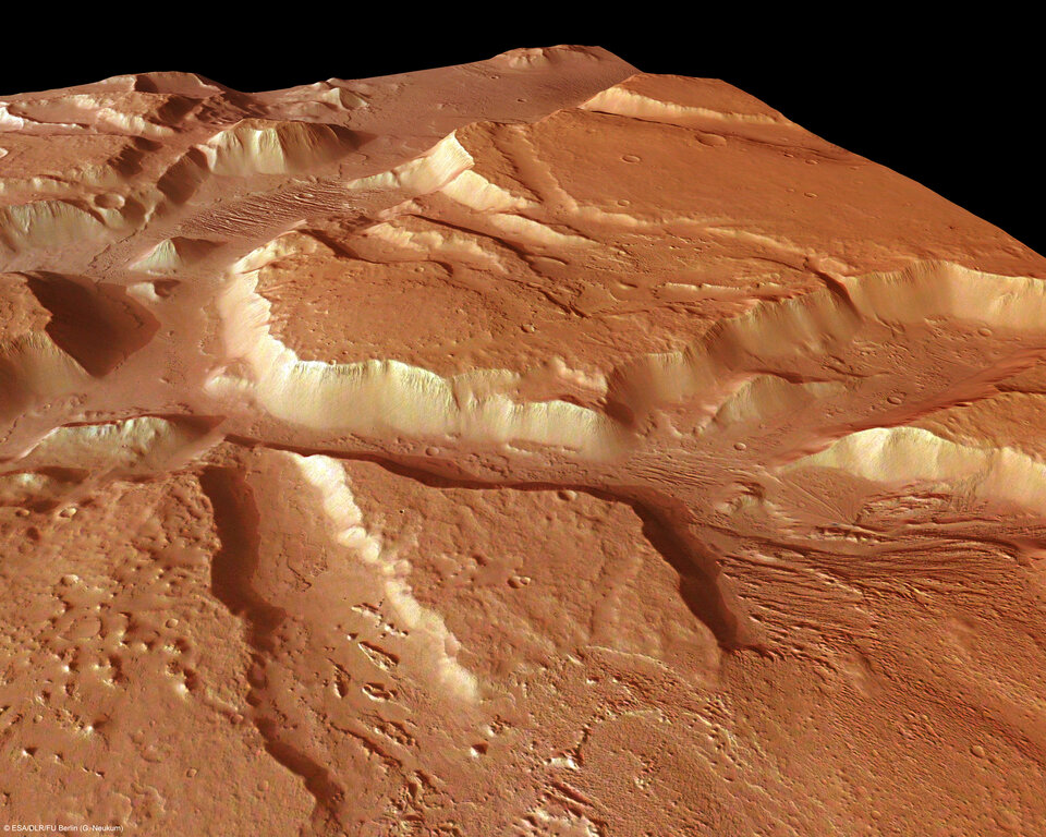
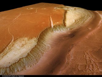
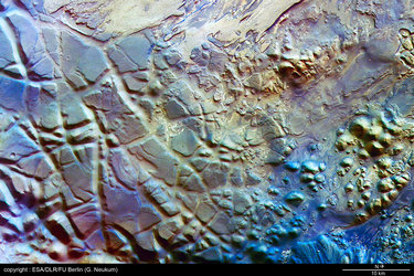
2500 metre-deep valleys are incised into the highlands in the northern part of the scene showing linear features on the floor of the valley. Although the origins are unclear, they may have been created by glacial processes, a conclusion drawn from the study of similar glacial grooves on Earth. But since the features are orthogonal to the elongation of the valley, a glacial origin is unlikely. It is possible that the features originate due to erosion caused by the wind.
Since the valleys lie close to the transition zone between the southern highlands and the northern plains (the crustal dichotomy boundary), scientists believe that the valleys might originate primarily from tectonic activity.
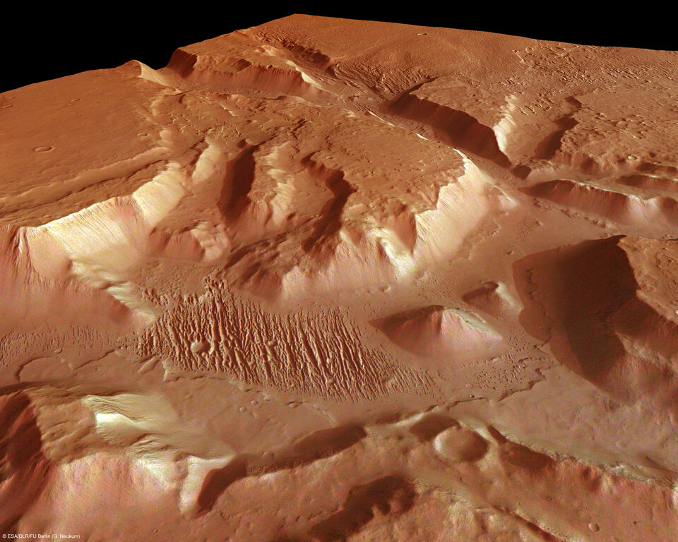
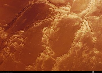
Aeolis Mensae is well-known for its features most probably related to aeolian, or wind-related, activity on the planet's surface and exhibits a number of so-called 'yardangs'.
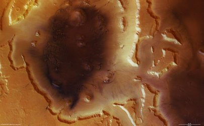
Yardangs are long, irregular ridges with sharp crests that lie between two round-bottomed troughs carved out by wind erosion in an arid region. In this picture, they are more or less linear to streamlined remnants of resistant material shaped by the action of sand-blown material which eroded the weaker material. They can reach a length of several hundred metres. The direction of the yardangs is from southeast to northwest indicating the prevalent wind direction.
These structures are also found in deserts on Earth where winds are the main agent of change for the landscape. Such features have previously been observed by Mars Express’ HRSC near Olympus Mons on 5 May 2004, orbit number 143.
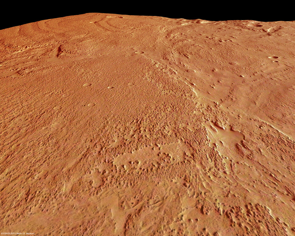
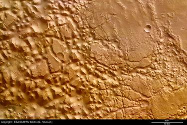
If the layered material is more resistant to the action of wind-blown sands, the landscape can be carved out differently, as can be seen in the southern and less dissected area of Aeolis Mensae, where individual layers become visible.
The images in colour have been derived from the three HRSC colour channels in combination with the nadir channel. The perspective view was obtained from a Digital Terrain Model derived from the HRSC stereo channels.
The 3D (anaglyph) images were calculated by pulling together data from the nadir channel and one of the stereo channels. The black and white high resolution images were derived from the nadir channel, which provides the highest level of detail.
The colour and nadir scenes are a mosaic of pictures derived from orbits 4136 and 4147. Image resolution has been decreased for easier downloading.
For more information on Mars Express HRSC images, please read our updated FAQ (frequently asked questions).