• → European Space Agency

      • Space for Europe
      • Space News
      • Space in Images
      • Space in Videos
    • About Us

      • Welcome to ESA
      • DG's News and Views
      • For Member State Delegations
      • Business with ESA
      • ESA Exhibitions
      • ESA Publications
      • Careers at ESA
    • Our Activities

      • Space News
      • Observing the Earth
      • Human Spaceflight
      • Launchers
      • Navigation
      • Space Science
      • Space Engineering
      • Operations
      • Technology
      • Telecommunications & Integrated Applications
    • For Public

    • For Media

    • For Educators

    • For Kids

    • ESA

    • Space Science

    • Our Universe
    • About Space Science
    • ESA's 'Cosmic Vision'
    • Science missions
    • Mission navigator
    • Target groups
    • For Media
    • For Scientists
    • For Kids
    • Multimedia
    • Science images
    • Science videos
    • Animations
    • Downloads
    • Sounds from space
    • Resources
    • Reference section
    • Services
    • FAQs
    • Glossary
    • Help
    • Portal terms of use
    • Comments
    • Follow us
    • RSS feeds
    • ESA Sci on Twitter
    • ESA Space Science Images on Flickr
    • ESA 3D on Flickr

    ESA > Our Activities > Space Science

    Aram Chaos in false colour

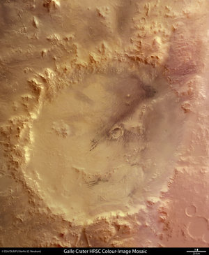
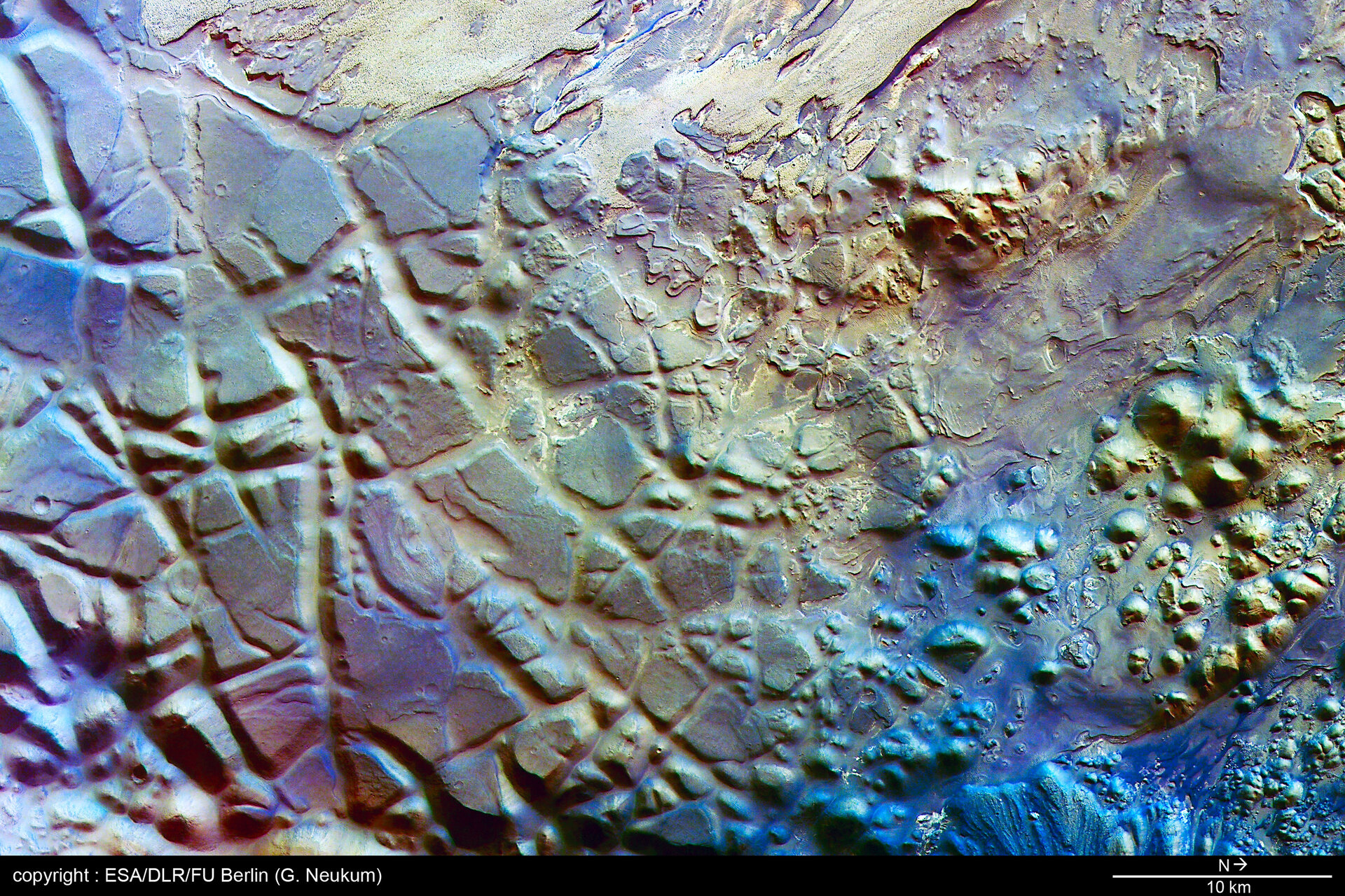
    Heavily eroded Aram Chaos

    30 May 2006

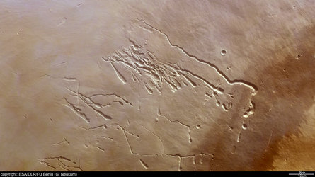
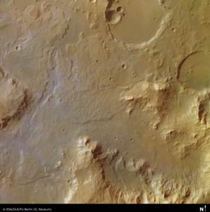
    These images, taken by the High Resolution Stereo Camera (HRSC) on board ESA's Mars Express spacecraft, show Aram Chaos, 280-km-wide circular structure characterized by chaotic terrain.

    Context map, Aram Chaos
    Map showing Aram Chaos in context

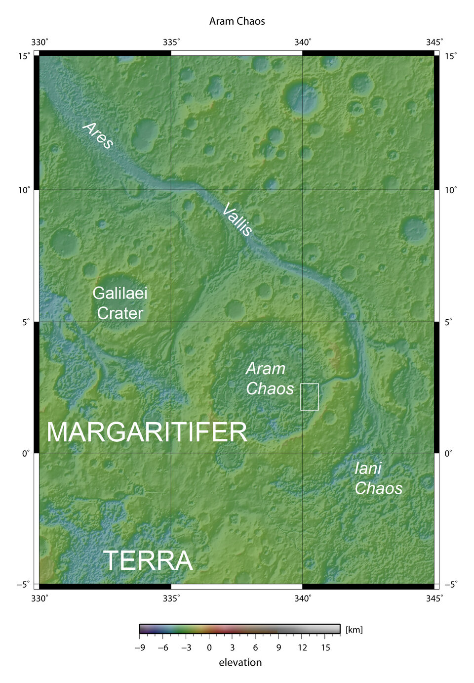
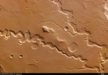
    The HRSC obtained these images during orbit 945 with a ground resolution of approximately 14 metres per pixel. The images show the region of Aram Chaos, at approximately 2° North and 340° East.

    Aram Chaos is a 280-km-wide almost-circular structure located between the outflow channel Ares Vallis and Aureum Chaos. It is one of many regions located east of Valles Marineris and characterized by chaotic terrain.


    Aram Chaos in colour
    Aram Chaos (north to the right)

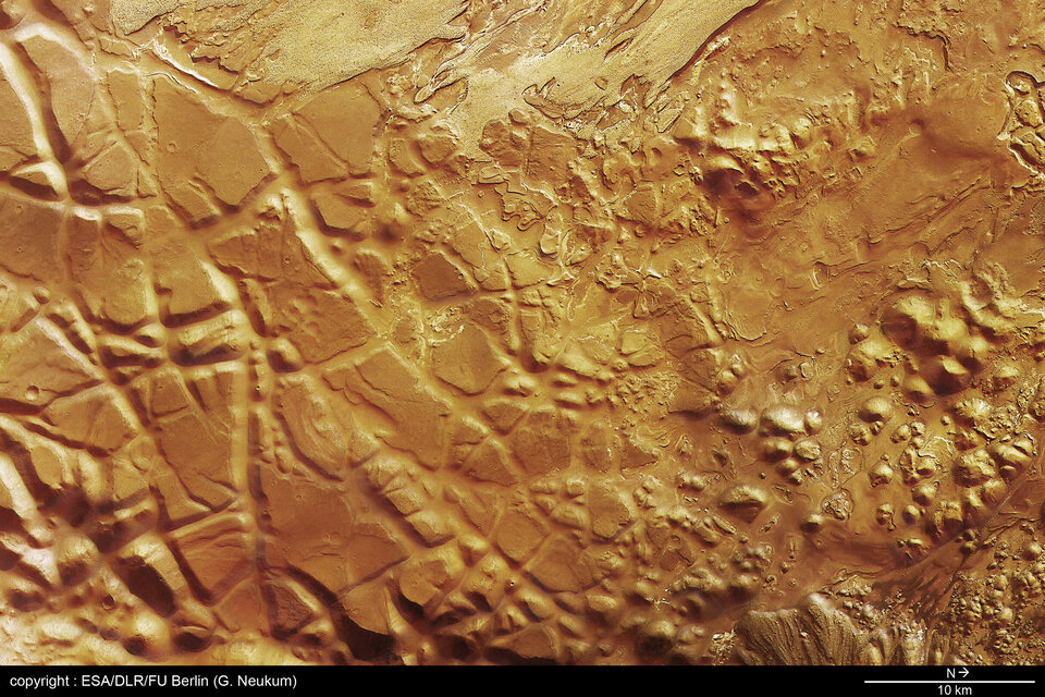
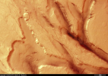
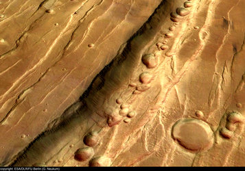
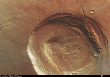
    As the name 'chaos' suggests, this terrain comprises large-scale remnant massifs, large relief masses that have been moved and weathered as a block. These are heavily eroded and dominate the circular morphology, or structure, which may have formed during an impact. As seen in the colour image, these remnant massifs range from a few kilometres to approximately ten kilometres wide and have a relative elevation of roughly 1000 metres.

    Aram Chaos, black and white

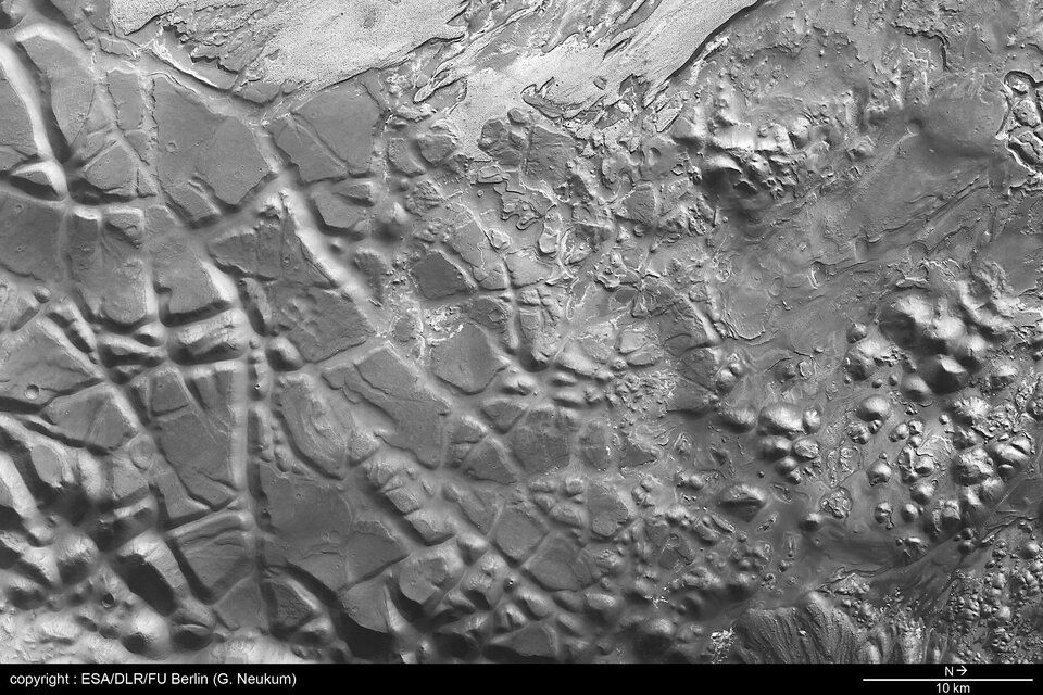
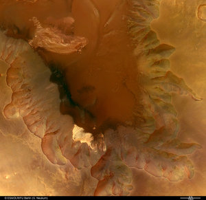
    The western region of the colour image is characterized by brighter material, which seems to be layered and could be the result of sedimentary deposition. Distinct layering, causing a terrace-like appearance, is also visible east of this brighter material and in the relatively flat region located in the northwest of the colour image.

    Perspective of Aram Chaos
    Aram Chaos, perspective view

    Some scientists believe that the numerous chaotic regions located in the eastern part of Valles Marineris were the source of water or ice thought to have created the valleys that extend into Chryse Planitia. These regions are particularly interesting because they may yield clues to the relationship between Valles Marineris, the chaotic terrain, the valleys and the Chryse basin.

    Aram chaos, in 3D
    Aram Chaos, 3D anaglyph

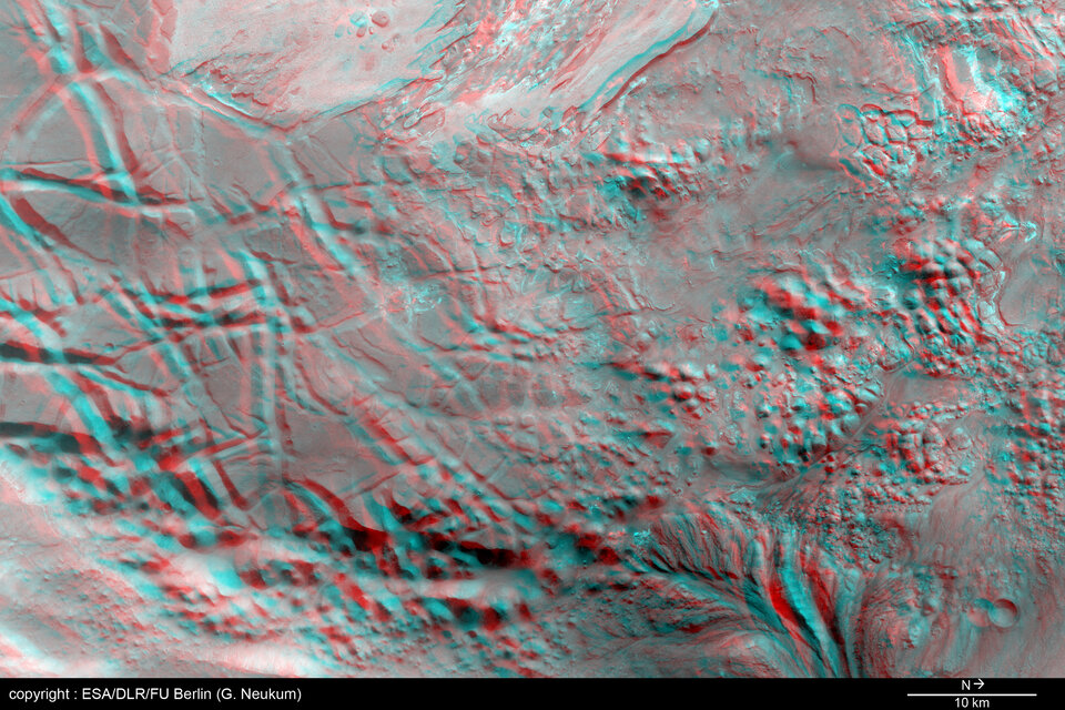
    The colour scenes have been derived from the three HRSC-colour channels and the nadir channel. The perspective view has been calculated from the digital terrain model derived from the stereo channels. The anaglyph image was calculated from the nadir and one stereo channel. Image resolution has been decreased for use on the internet.

    For more information on Mars Express HRSC images, please read our updated FAQ (frequently asked questions).

    Rate this

    Views

    Share

    • Currently 5 out of 5 Stars.
    • 1
    • 2
    • 3
    • 4
    • 5
    Rating: 5/5 (1 votes cast)

    Thank you for rating!

    You have already rated this page, you can only rate it once!

    Your rating has been changed, thanks for rating!

    176
    Tweet
    • Mars Express image browser
    • Recent images
      • Lava tubes on Pavonis Mons
        • Extensional tectonics in Tempe Terra
          • Nanedi Valles system on Mars
            • 'Happy face' crater on Mars
              • The Libya Montes valley on Mars
                • 'Hourglass'-shaped crater - new video and perspectives
                  • Eastern scarp of Olympus Mons
                    • Ausonia Mensa remnant massif
                      • Pits and tectonic grabens in Phlegethon Catena
                        • Claritas Fossae region of Mars
                          • Sulphate deposits in Juventae Chasma
                            • ‘Butterfly’ impact crater in Hesperia Planum
                              • Fly over the Chasma Boreale at Martian north pole
                                • The Biblis Patera volcano
                                • High Resolution Stereo Camera
                                  • Behind the lens...

    Connect with us

    • RSS
    • Youtube
    • Twitter
    • Flickr
    • G+
    • Facebook
    • Livestream
    • Subscribe
    • App Store
    • ESA Science Twitter

    Follow ESA science

    • LATEST ARTICLES
    • · Proba-V opens its eyes
    • · First new Galileo satellite arrive…
    • · Next destination: space
    • · Leak repaired on International Spa…
    • · After Chelyabinsk: European expert…
    • FAQ

    • Jobs at ESA

    • Site Map

    • Contacts

    • Terms and conditions