Germany
 Austria
 Belgium
 Denmark
 Spain
Spain
 Estonia
 Finland
 France
 Greece
 Hungary
 Ireland
 Italy
Italy
 Luxembourg
 Norway
 The Netherlands
 Poland
 Portugal
 Czechia
 Romania
 United Kingdom
 Slovenia
 Sweden
 Switzerland


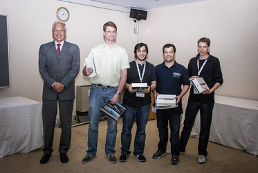
Harmful algal bloom forecasting service wins prize
An online service that monitors water quality for the aquaculture industry has been selected as this year’s most beneficial Earth-monitoring service for European citizens in the Copernicus Masters competition.
Following an online vote, HAB Forecast – Harmful Algal Bloom Forecast – won in the category of Best Service Challenge.
The service provides a weekly web bulletin alerting fish farmers and regulators of these harmful blooms. It is designed to combine information from in-situ monitoring stations, satellite data, and biological and physical oceanic models.
The service was submitted by Julie Maguire from the Daithi O’Murchu Marine Research Station, Ireland.
The Best Service Challenge is one of nine categories in the European Earth-monitoring competition Copernicus Masters, which rewards the best ideas for services, business cases and applications based on satellite Earth observation data.

The Best Service Challenge is one of nine categories in the European Earth-monitoring competition Copernicus Masters, which rewards the best ideas for services, business cases and applications based on satellite Earth observation data.
This particular Challenge aims to increase awareness of existing Earth-monitoring services and their benefits to European citizens. As the winner, HAB Forecast will be given access to commercial satellite data worth € 40 000.
Landmap – Spatial Discovery came in at second place. The service provides web-based access to spatial data and e-learning materials for the academic community.
Taking third place was SmartIrrigation – Satellite monitoring for agriculture. The tool helps farmers to optimise agricultural production through efficient irrigation based on the combination of remote sensing data and measurements from in-situ sensors.

The overall winner – the Copernicus Master – will be selected from among the winners of the Best Service Challenge, GEO Illustration Challenge, Ideas Challenge, ESA App Challenge, DLR Environmental Challenge, T-Systems Cloud Computing Challenge, European Space Imaging High-Res Challenge, Astrium Radar Challenge, and BMW ConnectedDrive Challenge.
The winner will receive an additional cash prize of € 20 000 and benefit from € 60 000 in satellite data, made available with the financial support of the European Commission.
Winners in all categories of this year’s Copernicus Masters will be announced at the Awards Ceremony on 5 November at the European Space Solutions conference in Munich, Germany.
Started in 2011 by ESA, the Bavarian Ministry of Economic Affairs, the DLR German Aerospace Center, Anwendungszentrum Oberpfaffenhofen and T-Systems GmbH, the competition is supported by the European Commission, European Space Imaging GmbH, Astrium GEO-Information Services, BMW Group and GEO magazine.
For a complete list of Challenges and more information on the competition, visit the Copernicus Masters website.