About ESA
The European Space Agency (ESA) is Europe’s gateway to space. Its mission is to shape the development of Europe’s space capability and ensure that investment in space continues to deliver benefits to the citizens of Europe and the world.
Highlights


Latest


Space in Member States
Find out more about space activities in our 23 Member States, and understand how ESA works together with their national agencies, institutions and organisations.
 Germany
 Austria
 Belgium
 Denmark
 Spain
Spain
 Estonia
 Finland
 France
 Greece
 Hungary
 Ireland
 Italy
Italy
 Luxembourg
 Norway
 The Netherlands
 Poland
 Portugal
 Czechia
 Romania
 United Kingdom
 Slovenia
 Sweden
 Switzerland
Science & Exploration
Exploring our Solar System and unlocking the secrets of the Universe
Go to topicAstronauts


Latest


Enabling & Support
Making space accessible and developing the technologies for the future
Go to topicLatest


The European Data Relay System monitors the Earth in almost real time
A satellite network that can zoom in on ships at sea and check for oil spills in almost real time has demonstrated its capabilities at a high-level international event in Brussels.
The demonstration of the capabilities of the European Data Relay System (EDRS) was made to delegates at the headquarters of the European External Action Service on 10 July.
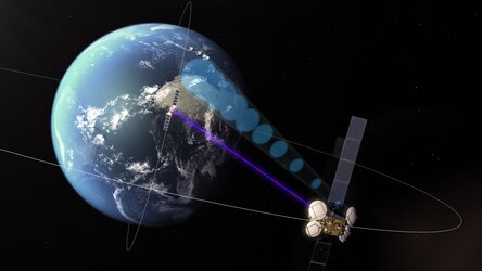
Dubbed the “SpaceDataHighway” by its private operator Airbus, EDRS enables Earth-observation satellites to deliver their information to users on the ground in near real-time, accelerating response to emergency situations and spurring the development of new services and products.
The system works by using lasers to speed up the collection of data from Earth-observation satellites that are in low Earth orbit.
Without EDRS these satellites can only relay their information when they are in direct line-of-sight with a ground station, which on average only happens every 90 minutes.
With EDRS, they send their data through space via laser to one of the EDRS satellites in a higher, geostationary orbit that have a constant view of a ground station.
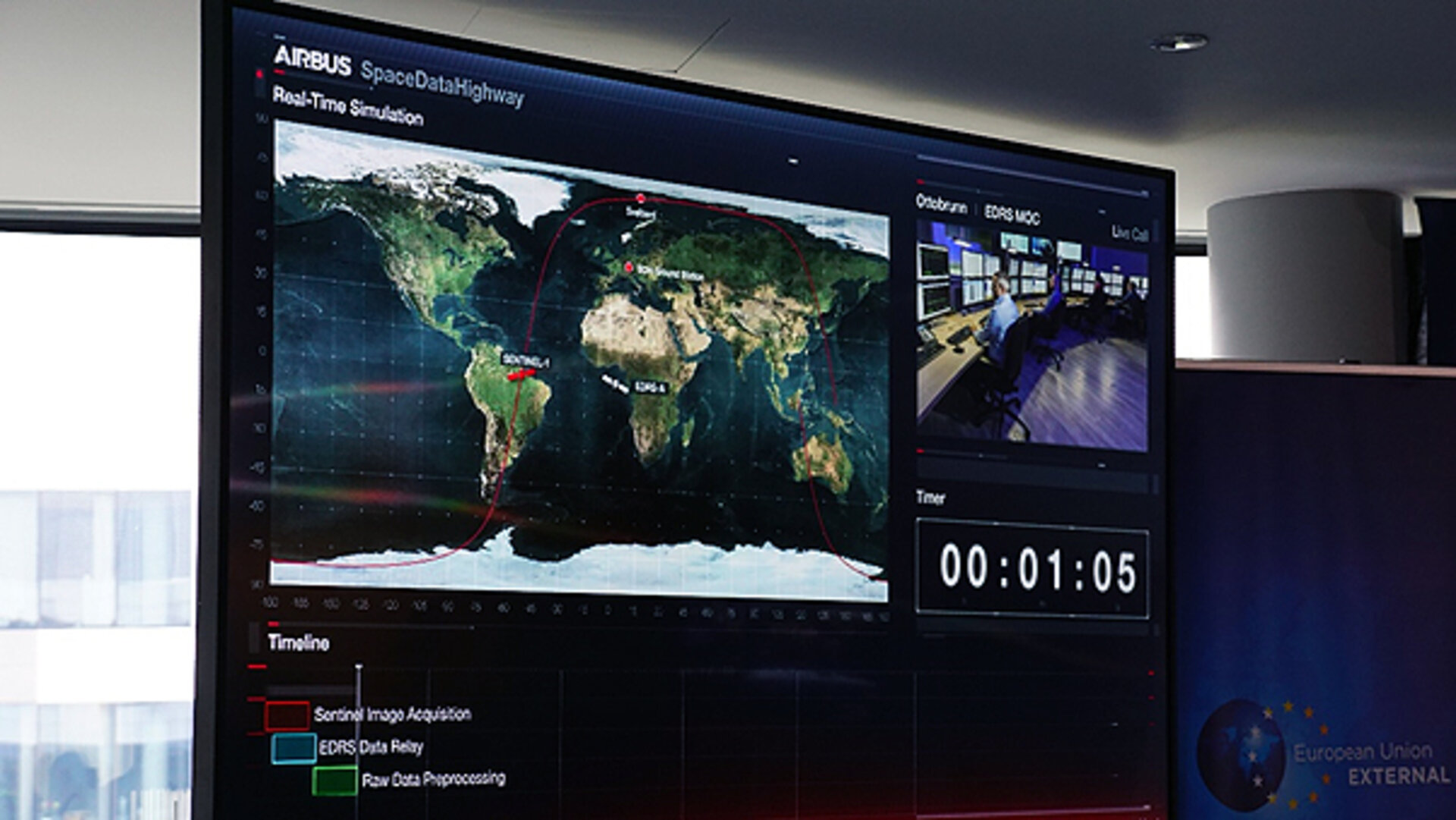
Delegates at the meeting watched staff from the European Maritime Safety Agency analyse images of ships off the coast of French Guiana that were captured just seconds earlier by an Earth-observation satellite called Copernicus Sentinel-1B as it orbited the planet.
The team were able to pinpoint individual ships on a 60,000 square kilometre patch of the Atlantic Ocean that was twice the size of Belgium.
They checked the ships’ wakes for any evidence of oil spills – and found none on this occasion.
The whole process took less than 20 minutes.