Earth from Space: Sentinel-2 captures Sentinel-2
The Copernicus Sentinel-2B satellite captured this image over Europe’s Spaceport in French Guiana on 2 September, just ahead of the Sentinel-2C launch.
Zoom in to explore this image at its full 10 m resolution or click on the circles to learn more.
Europe's Spaceport is situated in the northeast of South America in French Guiana, an overseas department of France. The spaceport lies northwest of Kourou, a coastal town on the estuary of the Kourou River, both visible near the centre of the image. After running for 144 km, the river flows into the Atlantic Ocean. The brownish hue of its muddy waters is most likely the result of sediment gathered from the nearby forest.
White, sandy beaches stretch along the ocean coast north of Kourou, while the riverbank and the interior regions are mostly covered by mangroves and dense tropical rainforest.
The spaceport is home to the ESA-developed Ariane and Vega rocket families, whose launch pads can be spotted in the top left corner of the image.
Thanks to its geographical position near the equator, the spaceport is ideally placed as launchers benefit from increased velocity owing to the ‘slingshot’ effect, created by the speed of Earth’s rotation.
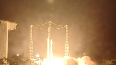
From here, the third Copernicus Sentinel-2 satellite, Sentinel-2C, launched on 5 September aboard the final Vega rocket.
The Sentinel-2 mission is based on a constellation of two identical satellites flying in the same orbit but 180° apart: currently Sentinel-2A and Sentinel-2B. With Sentinel-2C now in orbit, it will soon replace its predecessor, Sentinel-2A, prolonging the life of the mission and ensuring a continuous supply of data for Copernicus, the Earth observation component of the EU Space Programme.
Sentinel-2 data are currently being used for a broad range of applications, including agriculture, water quality monitoring, methane emissions detection and natural disaster management, including wildfires, volcanic eruptions and floods.