
Copernicus Sentinel-6 Michael Freilich: preparing for launch

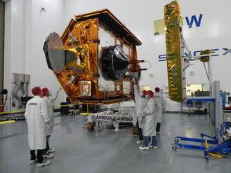
A European satellite built to carry out precise measurements of sea level changes has arrived in California in preparation for launch. The Sentinel-6 Michael Freilich satellite forms part of the European Union’s Copernicus Earth Observation programme and will employ radar to map sea surface topography.
The mission will be used to monitor the height of the sea surface to understand long-term change. It will also measure wave height and wind speed. The satellite will provide fundamental data for climate science, policy-making and protecting the 600 million people who live in vulnerable coastal areas.
Data are provided to Copernicus services in near-real time to improve marine and weather forecasts used by maritime and coastal communities.
The mission is a collaboration between ESA, the European Commission, EUMETSAT, NASA and NOAA, with support from the French Space Agency CNES.
It is named Michael Freilich after NASA’s former Director of Earth Science and is scheduled for launch on 10 November on a SpaceX Falcon 9 rocket from the Vandenberg Air Force Base.
This A-roll contains Copernicus Sentinel-2 images of the Maldives, new in-orbit animations and clean-room footage from testing in Germany.

Touchdown: Copernicus Sentinel-6 Michael Freilich ar…
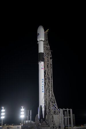
Copernicus Sentinel-6 Michael Freilich on the launch pad

Copernicus Sentinel-6 Michael Freilich
Eyes on Copernicus Sentinel-6 Michael Freilich
