
GAS demonstrator
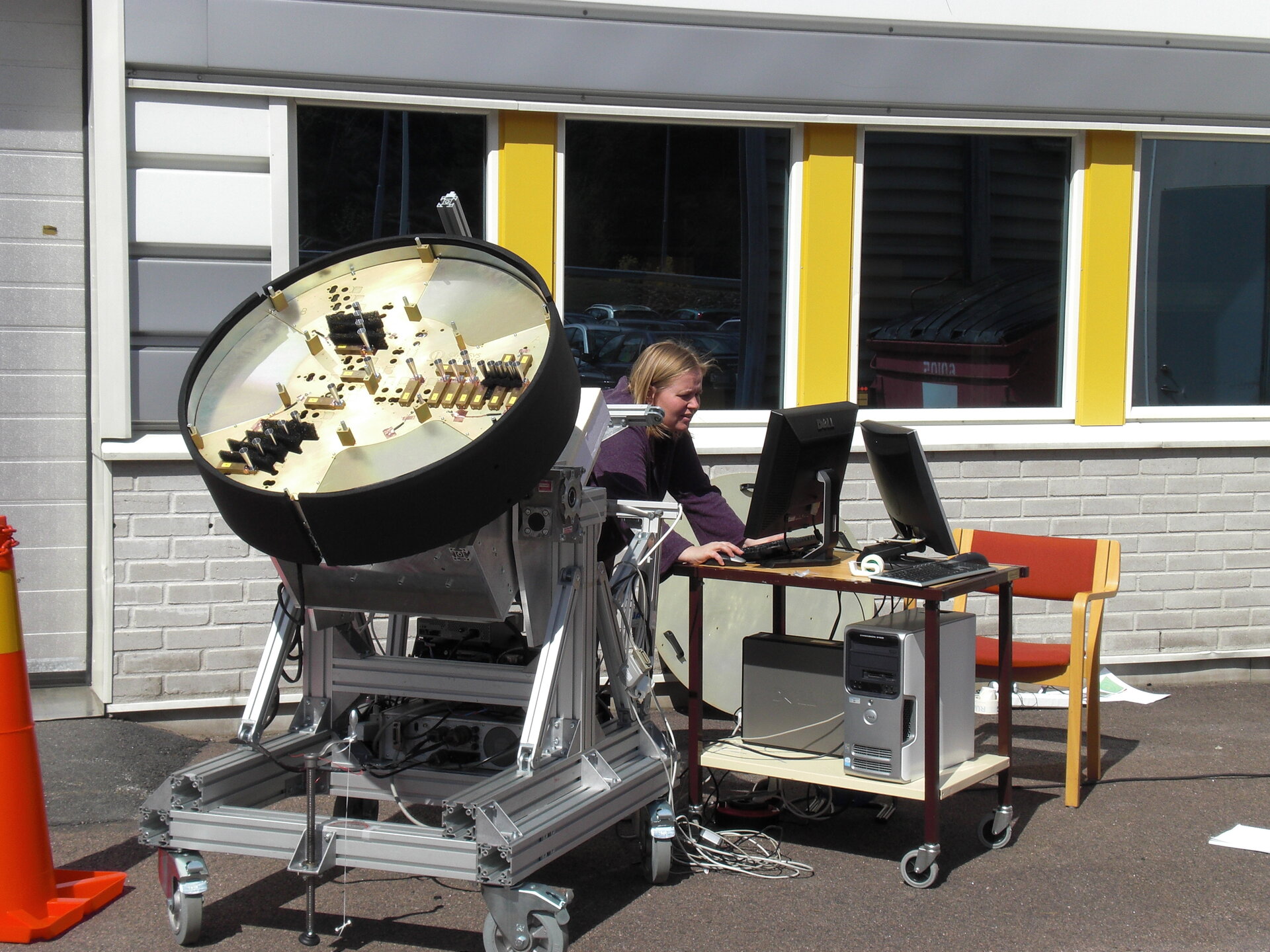
Geostationary Atmospheric Sounder demonstrator during outdoor testing.
The GEO Atmospheric Sounder is a mm-wave imaging sounder considered for future meteorological and climate observation satellites. Frequency bands around 53 GHz, 118 GHz, 183 GHz, and 380 GHz are included to satisfy the user requirements for vertical profiles of temperature and humidity under all weather conditions. The primary advantage of a Geostationary Earth Orbit (GEO) for remote sensing, compared with a Low-Earth Orbit (LEO), is that continuous monitoring is possible over a large area of the Earth's surface and atmosphere. This is highly desirable for nowcasting, and short range forecasting of rapidly evolving meteorological phenomena such as deep low pressure systems and storms.
The GEO location implies however that the imaging distance is 40-folded as compared to LEO as is the required effective aperture diameter - a diameter in the order of 8 m is needed. The instrument therefore consists of on an innovative configuration of a rotating sparse array of interferometer elements configured in a Y-shape geometry. The rotating configuration allows for a reduced number of elements relative to a stationary Y-shape interferometer. The rotation also provides useful information for relative phase calibration. The required dense sampling of the visibility function over the complete u-v-plane is achieved after half a revolution of the array.
A 21-element demonstrator representing the central part of the 53 GHz interferometer has been developed to demonstrate the imaging concept. The demonstrator supports full polarimetric measurements with a maximum baseline of ~75 cm, equivalent to 300 km resolution if positioned in geostationary orbit. The first images from outdoor measurements show that the imaging concept and algorithms performs as intended and it also demonstrates that the hardware technology is capable of receiving and detecting the very weak noise signals with sufficient sensitivity and stability to enable the system to be implemented.


