Mars Express radar data indicating heaps of water ice at Mars’s equator
Close to Mars’s equator lies the Medusae Fossae Formation (MFF), a fascinating wind-sculpted region that may be the biggest single source of dust on Mars.
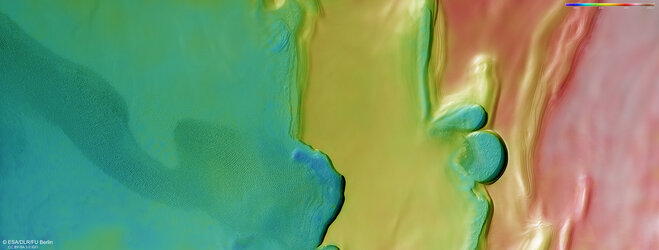
When Mars Express turned its MARSIS radar sounder instrument towards the MFF, it revealed a surprise. The radar signals that echoed back match what we’d expect to see from layered deposits rich in water ice.
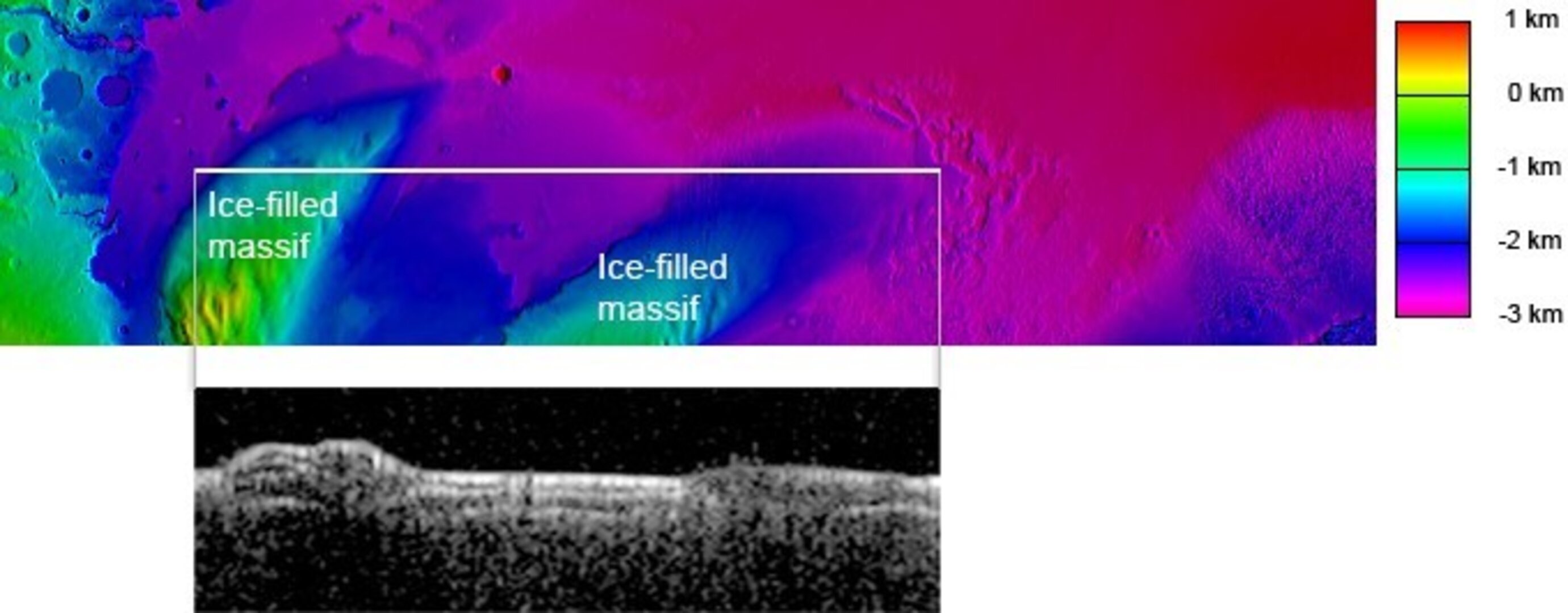
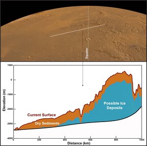
In this image, the white horizontal line on the coloured height map of Mars’s surface (top) shows a narrow stretch of land that was scanned by MARSIS. The pop out below shows the radar data collected by the instrument that reveals the subsurface; the brighter the area, the stronger the radar echo received from that area.
The white line covers two mounds separated by a valley. These mounds are clearly visible in the radar data below. Analysis of the radar data suggests that beneath a thick layer of dry material (likely dust or volcanic ash), the mounds are filled with water ice.
[Image description: Top rectangle shows a colourful map of the surface of Mars, with higher land indicated in red/green, and lower land indicated in purple/blue. A white line crosses part of the coloured map horizontally. From each end of the white line grey lines come down to a black-and-white pop out showing the shape of the surface, with two mounds clearly visible, corresponding to the higher land in the coloured map above. Below the surface are layers of bright white and dark black.]
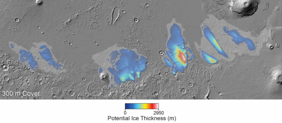
Map of suspected ice at Mars’s equator
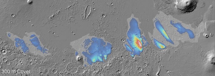
Map of suspected ice at Mars’s equator
Possible water ice at Mars’s equator
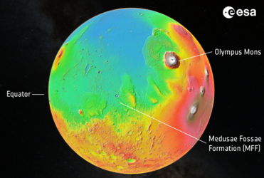
Location of Mars’s Medusae Fossae Formation