


 Germany
 Austria
 Belgium
 Denmark
 Spain
Spain
 Estonia
 Finland
 France
 Greece
 Hungary
 Ireland
 Italy
Italy
 Luxembourg
 Norway
 The Netherlands
 Poland
 Portugal
 Czechia
 Romania
 United Kingdom
 Slovenia
 Sweden
 Switzerland


ESA reaches out to maritime communities
We are inviting the operators, players and stakeholders of the European maritime world and the 'blue economy', as well as their associations, to share their understanding of the current role of space systems, data and products in their daily work. Through addressing these European entities with a short questionnaire, we would also like to know how space-based systems and data can help in developing, safeguarding and enabling sustainable growth in the maritime sector.
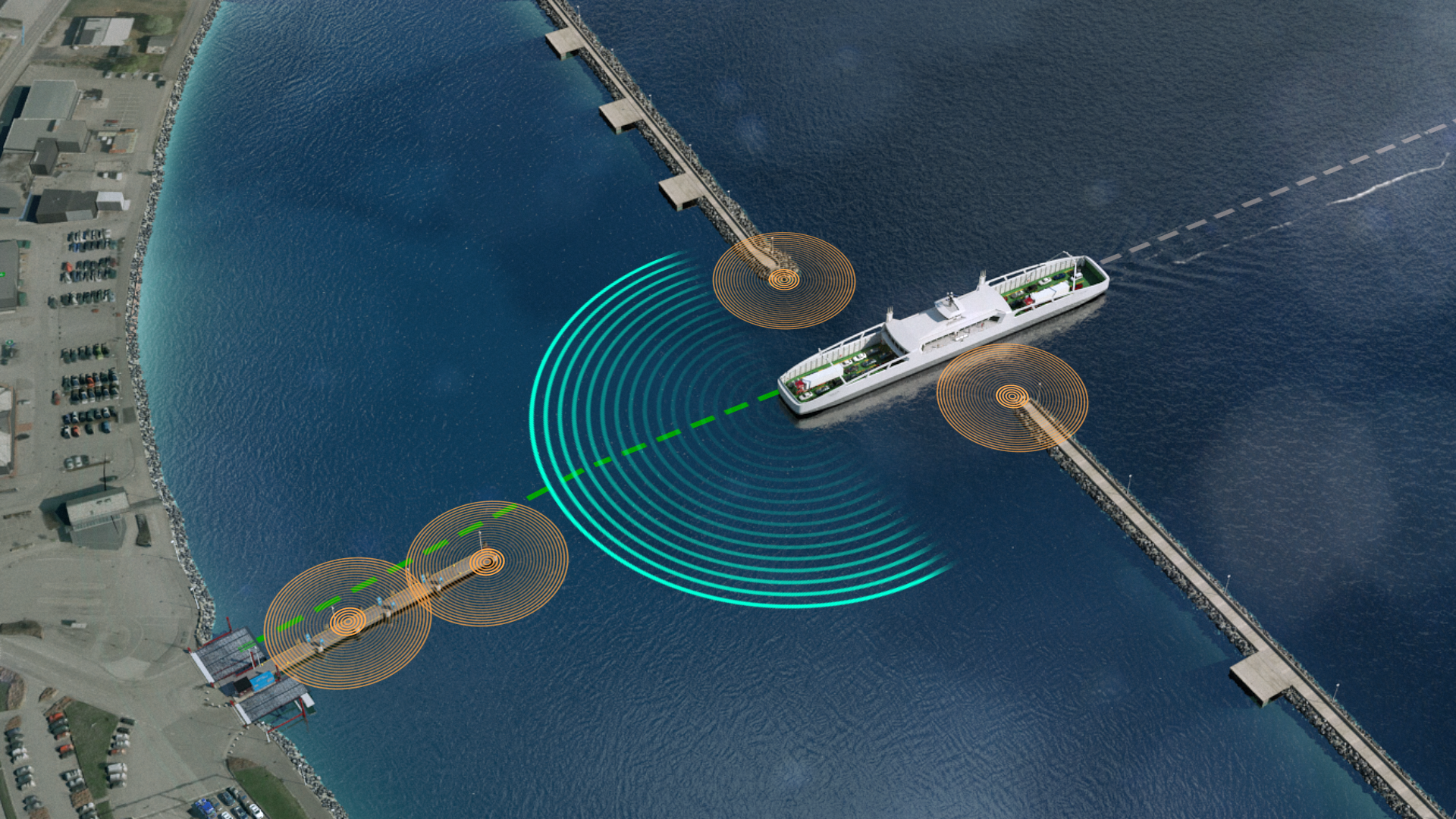
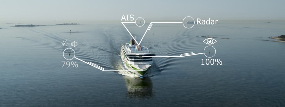
For 50 years ESA has been pooling the resources, ingenuity and industrial capability of a growing number of European countries (currently 22 Member States) to enable Europe to benefit from space-based systems and capabilities. Initially limited to meteorology and communications, in recent years space systems have greatly improved their reach and performance. The systems themselves, as well as the resulting data and products, are today critical for understanding the dynamics of the Earth system, for contributing to the safety and security of human activities, and for supporting recovery from natural or anthropogenic disasters. In particular, satellites enable precision positioning and navigation; derived applications such as Automated Identification Systems (AIS) are used extensively by vessels throughout the world. This enables, for example, illegal activities at sea to be detected.

Over the years, ESA has enlarged its portfolio of collaborative programmes, covering Earth observation, global navigation and positioning, as well as advancing telecommunications and space exploration. Today, ESA is one of the few space agencies worldwide carrying out activities and missions across all space domains. Such a wealth of knowledge and competence was bound to lead to a holistic approach, whereby space systems and data – irrespective of their denomination – are bundled together to provide the best possible service or to tackle challenges either at regional level or for a specific community or topic.
This is the underpinning logic of ESA's Regional Initiatives, one of which is the Blue Worlds Task Force (BWTF). Building on the vision and drive of a number of Member States, ESA has brought together representatives from all ESA Member and Associated States as well as ESA experts from different disciplines and backgrounds to establish the task force.
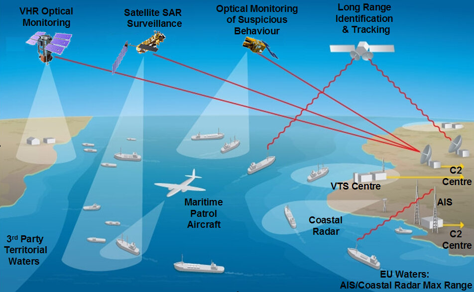
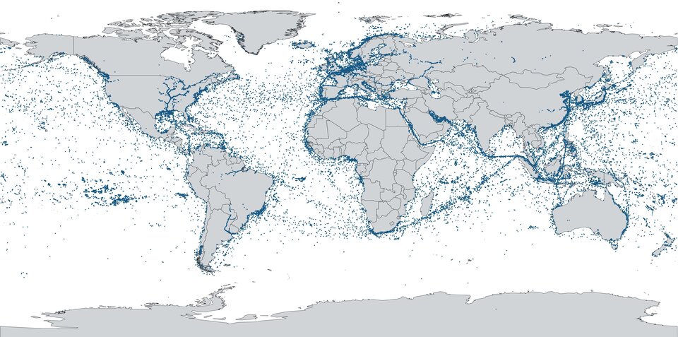
ESA Member States collectively possess the world’s largest maritime Exclusive Economic Zone (EEZ). The safeguarding of economic, environmental and geopolitical interests, as well as safety and security, depends on our ability to monitor, control, defend, connect and exploit the maritime territory, its resources and its pathways. The global situational awareness of maritime spaces is also a key element.
For many years, ESA has devoted a number of initiatives to the oceans, including to their monitoring and safeguarding, as well as to supporting the blue economy and its sustainable growth. Member States contribute to ESA activities whilst fostering their own strategies and activities both at national and EU levels.
A thorough mapping of all these ESA activities – current and planned – was the basis of the Blue Worlds Task Force. A concise 'concept note' defined the scope and the objectives of the BWTF.
A further step forward for the BWTF involved gathering input from the target end beneficiaries of the data and products that space systems must provide and support. These users are a diverse, very large and important part of our societies. They include fishing communities, ship owners and operators as well as their crews, port authorities, ship builders, coast guards, insurance companies, and economic and research entities involved in either the blue economy or in the study, preservation and exploitation of ocean ecosystems, to name just a few. These users can be represented by private enterprises of different sizes, trade associations, public entities and other types of organisation.
ESA has prepared this questionnaire with the aim of gaining a snapshot of how the target users envision the role of space in their daily work today as well as in the future. In particular, the questionnaire explores the potential role of space in the maritime world as we move towards a greener and more sustainable maritime economy, while preserving the economic importance of activities at sea.

The questionnaire is divided into three parts. The first part is devoted to collecting the profiles and roles of the addressed users in the maritime sector. The second part is devoted to understanding how space applications are perceived in the maritime domain, including the current and future applications. The third and final part is devoted to the option of establishing follow-up action together with space experts to respond to any queries or issues that may have been raised.
The answers to the questionnaire are anonymous by default unless the target users advise otherwise. The questionnaire is distributed through direct ESA contacts and by various other means (for example, emails or social media) or through the ESA Member State delegations represented in the BWTF. The results will be collected, processed and analysed by ESA experts and the resulting data will be available in the second quarter of 2021.
ESA will be collecting responses to the questionnaire until 7 March 2021. Any clarification requests, questions or queries can be addressed to Piero Messina (piero.messina[@]esa.int).
