Mapping Chernobyl fires from space
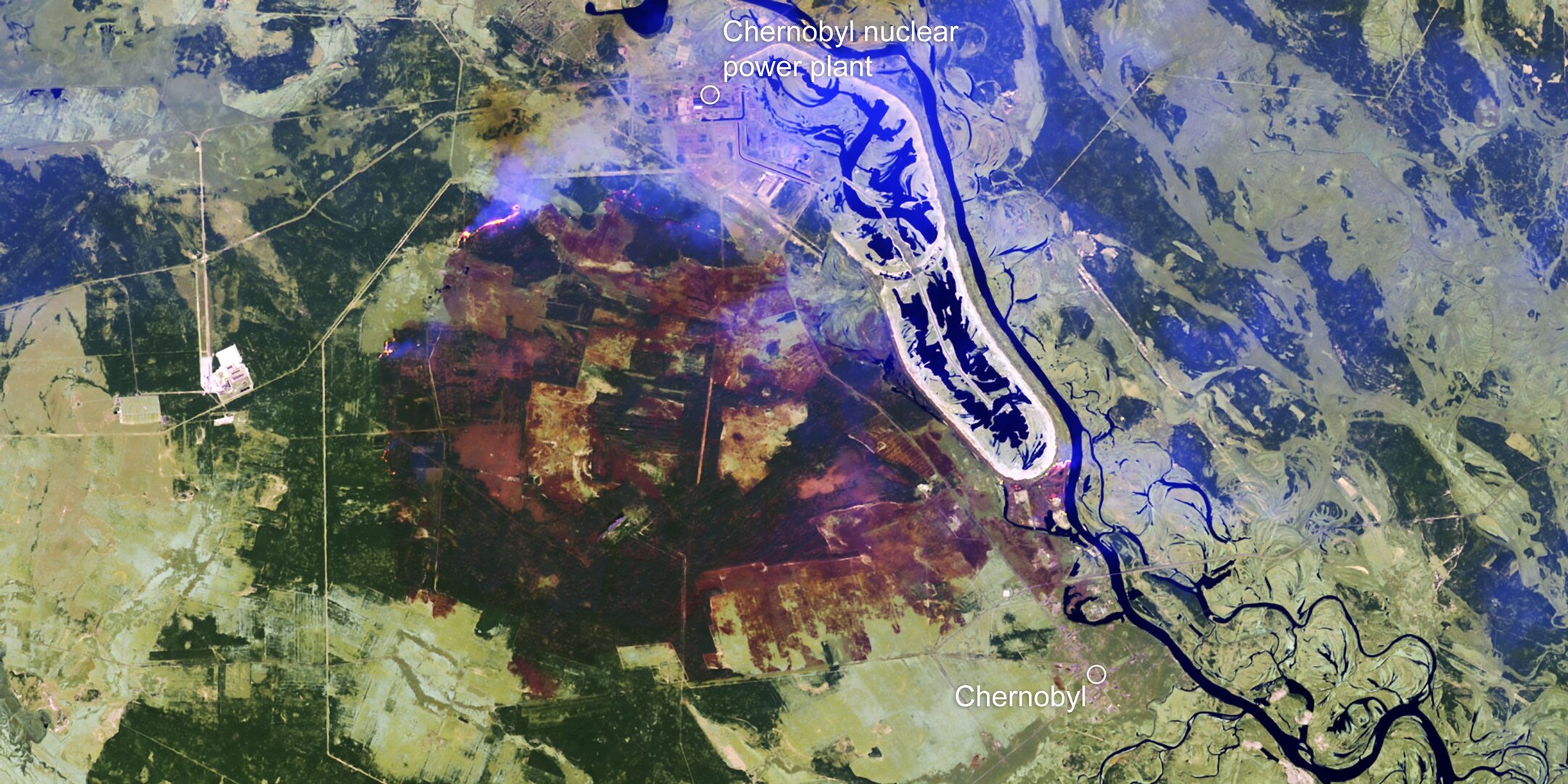
With an outbreak of wildfires recently threatening the closed Chernobyl nuclear power plant in the Ukraine, the Copernicus Emergency Mapping Service has been activated and the Copernicus Sentinel-2 satellite mission has imaged the fires and smoke, and mapped the resulting area of burned ground.
Thankfully, heavy rain yesterday means that most of the flames have now been extinguished. Nevertheless, the Ukrainian authorities also reported yesterday that there was still more than 500 firefighters, 124 fire engines and several helicopters still working to contain the smouldering.
In 1986, the nuclear site suffered a disastrous meltdown that spread radioactive fallout across Europe. The concerns were that the fires could reach the defunct nuclear reactor and a storage site for radioactive waste, and that there could be a risk of exposure to increased radiation from the burning of contaminated forest and soil.
Fires around Chernobyl are a seasonal phenomenon, but have been worse than normal this year owing to a mild winter and spring that has left the forest floor dry.
Satellites are key to keeping an eye on vulnerable regions such as this.

Each of the two satellites in Copernicus Sentinel-2 constellation is equipped with a wide-swath multispectral sensor that can image in 13 spectral bands.
The mission is being used as part of an activation of the Copernicus Emergency Management Service to provide maps of the burned area to help authorities respond to the consequences of this recent fire. The image on the right is an example of a map being provided through the service.
Using satellite data, the service provides information for emergency response for different types of disasters, including meteorological and geophysical hazards, deliberate and accidental disasters, humanitarian disasters, and for prevention, preparedness, response and recovery activities.
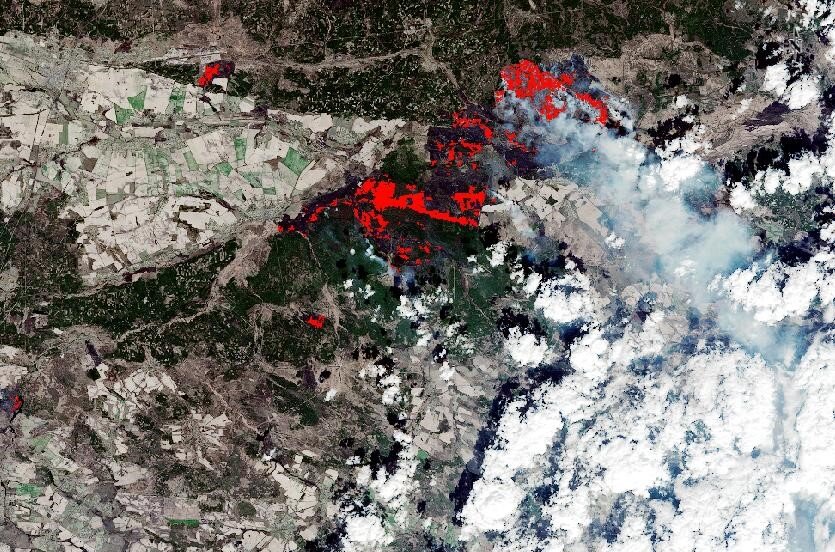
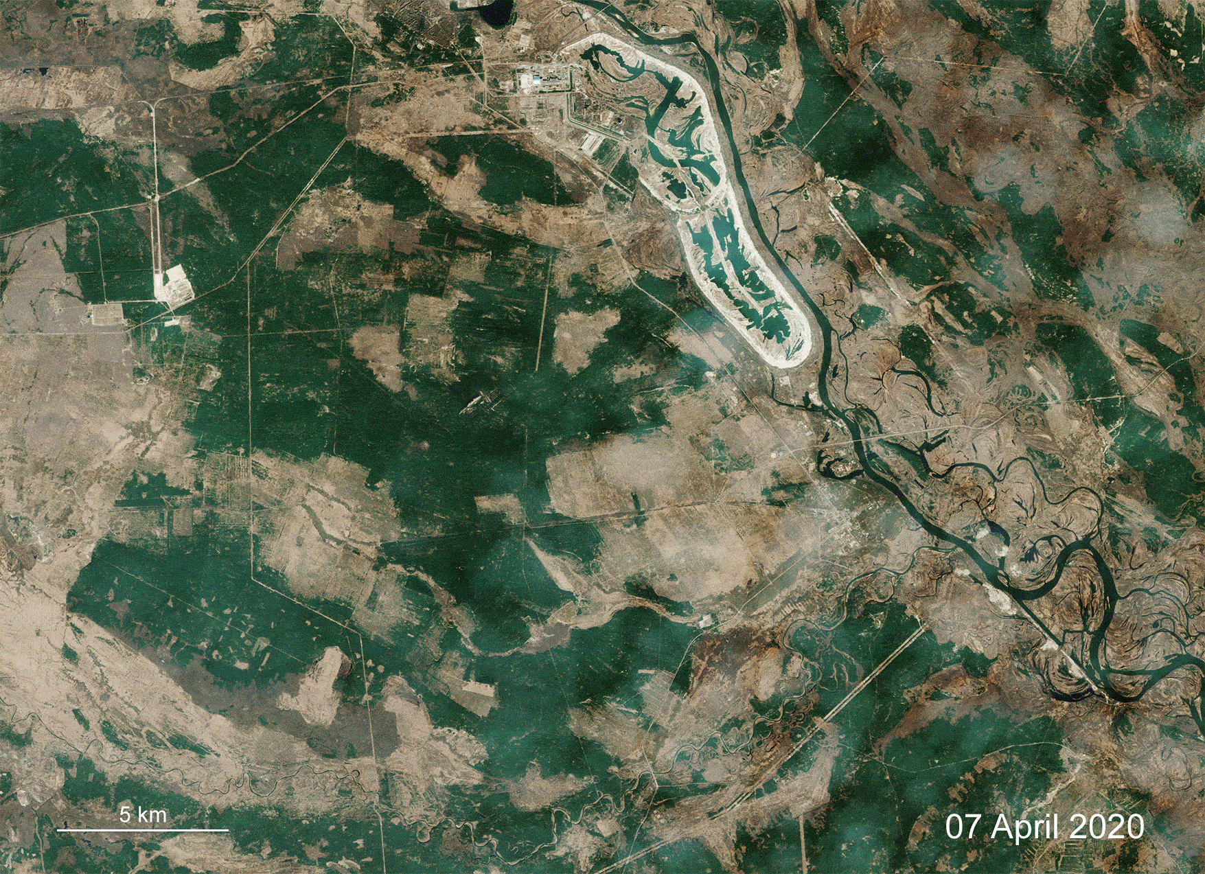
The animation featured above uses images from Copernicus Sentinel-2 to show the situation prior to the fires on 7 April, and then on 12 April. The image from 12 April is from one acquisition, but has been processed to show the smoke from the fires and then the burned area through the smoke.
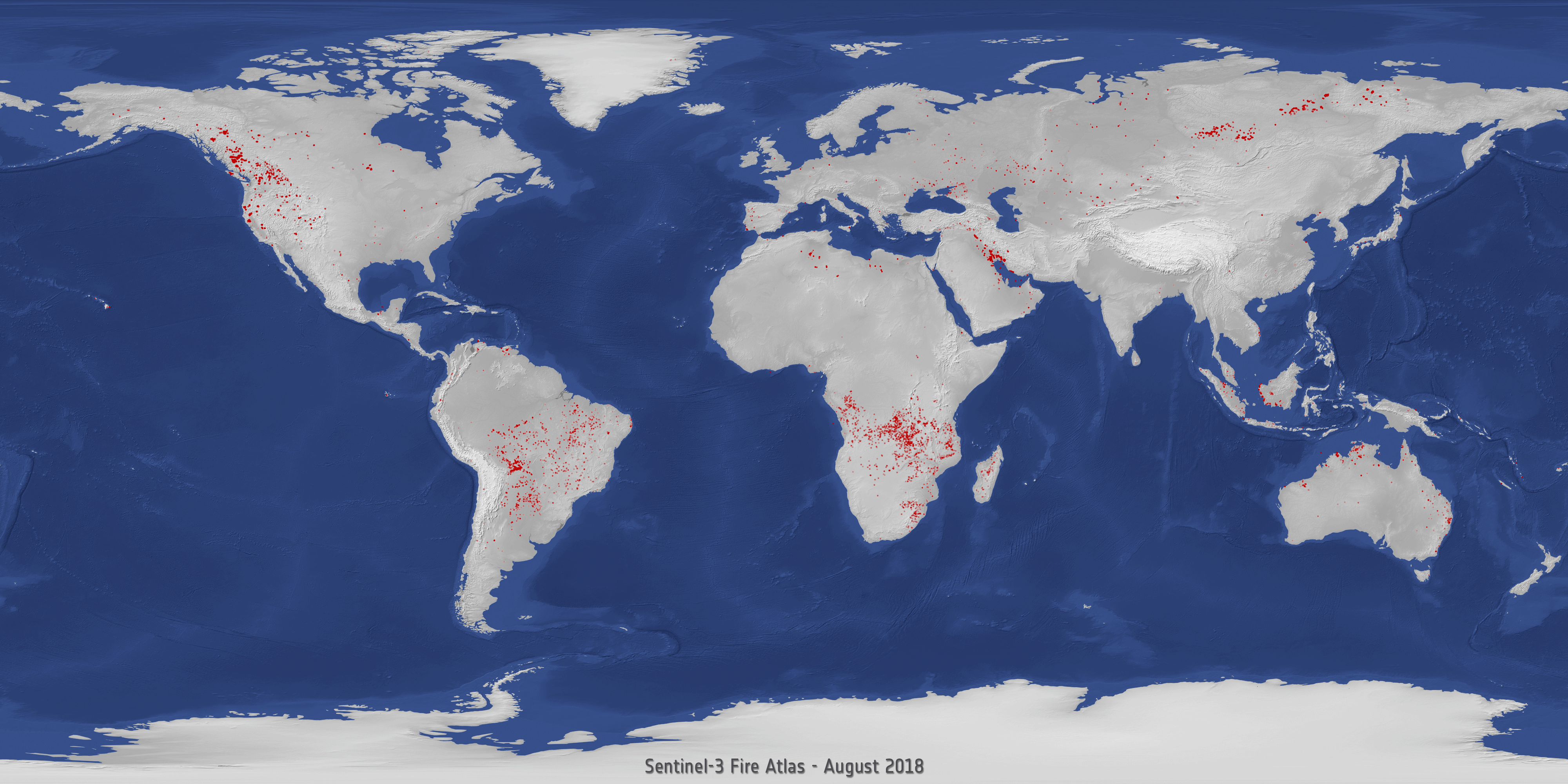
In parallel, the Copernicus Sentinel-3 mission also recorded the fires and the data is displayed in the Sentinel-3 World Fire Atlas Prototype, which is also able to provide a breakdown of these fires per continent.