Germany
 Austria
 Belgium
 Denmark
 Spain
Spain
 Estonia
 Finland
 France
 Greece
 Hungary
 Ireland
 Italy
Italy
 Luxembourg
 Norway
 The Netherlands
 Poland
 Portugal
 Czechia
 Romania
 United Kingdom
 Slovenia
 Sweden
 Switzerland


Satellite images and artificial intelligence unite to spot illegal activity at sea
Dangerous deeds like piracy, overfishing and human trafficking can be difficult to catch when they take place in the open ocean. A new ESA-backed study will explore how artificial intelligence could be combined with satellite radar images to spot tiny motions of boats to detect and recognise such activities.
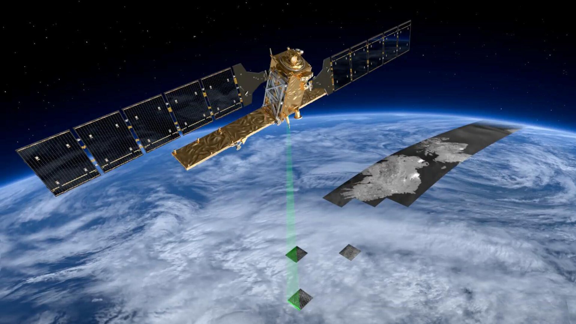
Synthetic Aperture Radar (SAR) is a detection system carried on board many satellites that sends out and receives pulses of radio waves to create very detailed images of the Earth’s surface below. It can work anytime and anywhere, under any light conditions and independent of cloud coverage. This makes SAR very attractive for maritime monitoring compared to optical sensors that don’t have the same ability.

This new research will be carried out by a PhD student at the University of Strathclyde and will be co-funded by ESA, the university and aerospace company BAE Systems. Working under ESA's Data System Division, the student will develop an algorithm that uses artificial intelligence to assess SAR images and call attention to specific maritime targets.
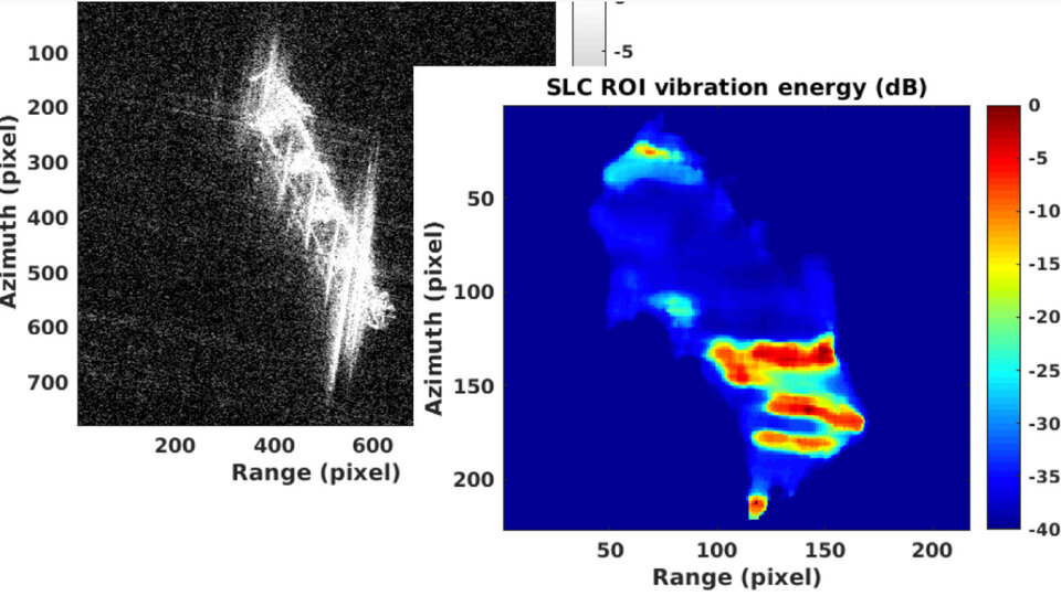
"Slight motions such as those caused by the vibration of an engine affect what a boat looks like in a SAR image," explains Carmine Clemente, who will supervise the research from the University of Strathclyde. "We will develop an algorithm to detect these motions and then test it on SAR images from the Copernicus Sentinel-1 satellites, as well as the Italian COSMO-SkyMed satellites."
As the resolution of SAR can be poorer than in optical images, extra information is needed to recognise vessels. This is where state-of-the-art artificial intelligence comes in to automatically extract vessel information.
The algorithm will have many applications, including recognising unlawfully seized ships with fake tracking systems and enabling authorities to monitor fishing vessels to prevent overfishing. It will also recognise simple human trafficking vessels; these often carry no tracking systems at all and can be perilous at sea.
We are likely to see the algorithm being used for future missions, including the Copernicus ROSE-L radar satellite, from which SAR data will be used simultaneously with an automatic identification system.
This research is one of the latest ideas received through ESA's Open Space Innovation Platform (OSIP) through which anybody can propose novel ideas to address space-related challenges. Other OSIP-submitted research ideas selected for funding in March 2020 include developing a system to gather and purify lunar soil to support living on the Moon, creating advanced antioxidants to reduce aging and degenerative disease in space, and getting a better understanding of the re-entry of space debris into Earth’s atmosphere.
OSIP is implemented by ESA Discovery & Preparation but invites ideas from across ESA's scope of activities – take a look for yourself.