Earth from Space: Hardap Dam, Namibia
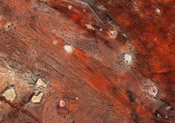
Resembling a Martian-like surface, this Copernicus Sentinel-2 image shows part of the Hardap region in south-central Namibia on the western edge of the Kalahari Desert.
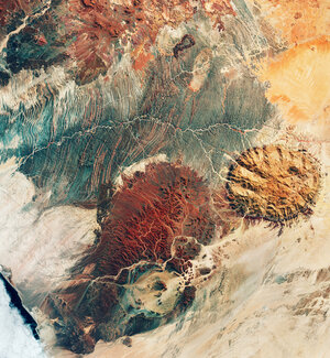
Zoom in to explore this image at its full 10 m resolution or click on the circles to learn more.
Hardap is a hot and arid region, where groundwater is difficult to obtain. Its name reflects the importance of the Hardap Dam, Namibia’s second largest dam, visible in blue in the centre of the image. The various blue hues denote the presence of sediment in the water.
With a surface area of 25 sq km, the dam supplies electricity and water to the whole area and the reservoir is home to numerous examples of Namibia’s wildlife.
The dam controls the flow of the Fish River, which can be seen snaking its way across the image. In this false-colour image, captured on 28 August 2024, the Copernicus Sentinel-2’s near-infrared channel was used to highlight vegetation in red, which appears mainly concentrated south of the dam along the river.
Agricultural fields can be spotted on the floodplain below the dam, where mainly vegetables and citrus fruits are grown. The different shades of red show the state of the crops: the brighter the red, the healthier is the vegetation.
About 20 km southeast of the dam, on the eastern bank of the river, lies the town of Mariental, the region’s capital. Its urban environment can be seen as a blend of red and grey dots. Near Mariental, the rocky plain of the Central Highland merges with the dry, sandy soil of the western limits of the Kalahari Desert.
The entire western Kalahari is characterised by long chains of sand dunes. Some of these dunes can be seen in shades of yellow in the top-right corner and appear surprisingly parallel and uniform.
On the right side of the image, the landscape is dotted with dry lake beds known as salt pans, seen as gleaming white circles.
Roads can be identified as white lines cutting sharply across the landscape.