Germany
 Austria
 Belgium
 Denmark
 Spain
Spain
 Estonia
 Finland
 France
 Greece
 Hungary
 Ireland
 Italy
Italy
 Luxembourg
 Norway
 The Netherlands
 Poland
 Portugal
 Czechia
 Romania
 United Kingdom
 Slovenia
 Sweden
 Switzerland


Beating the dust
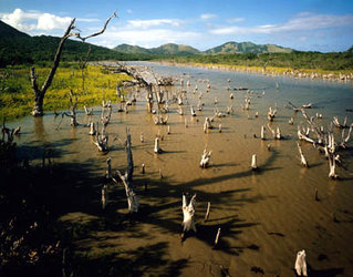
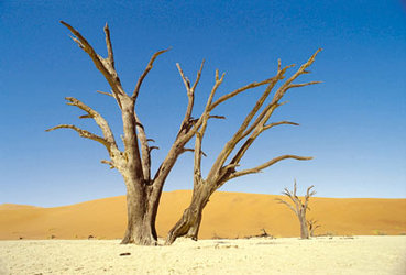
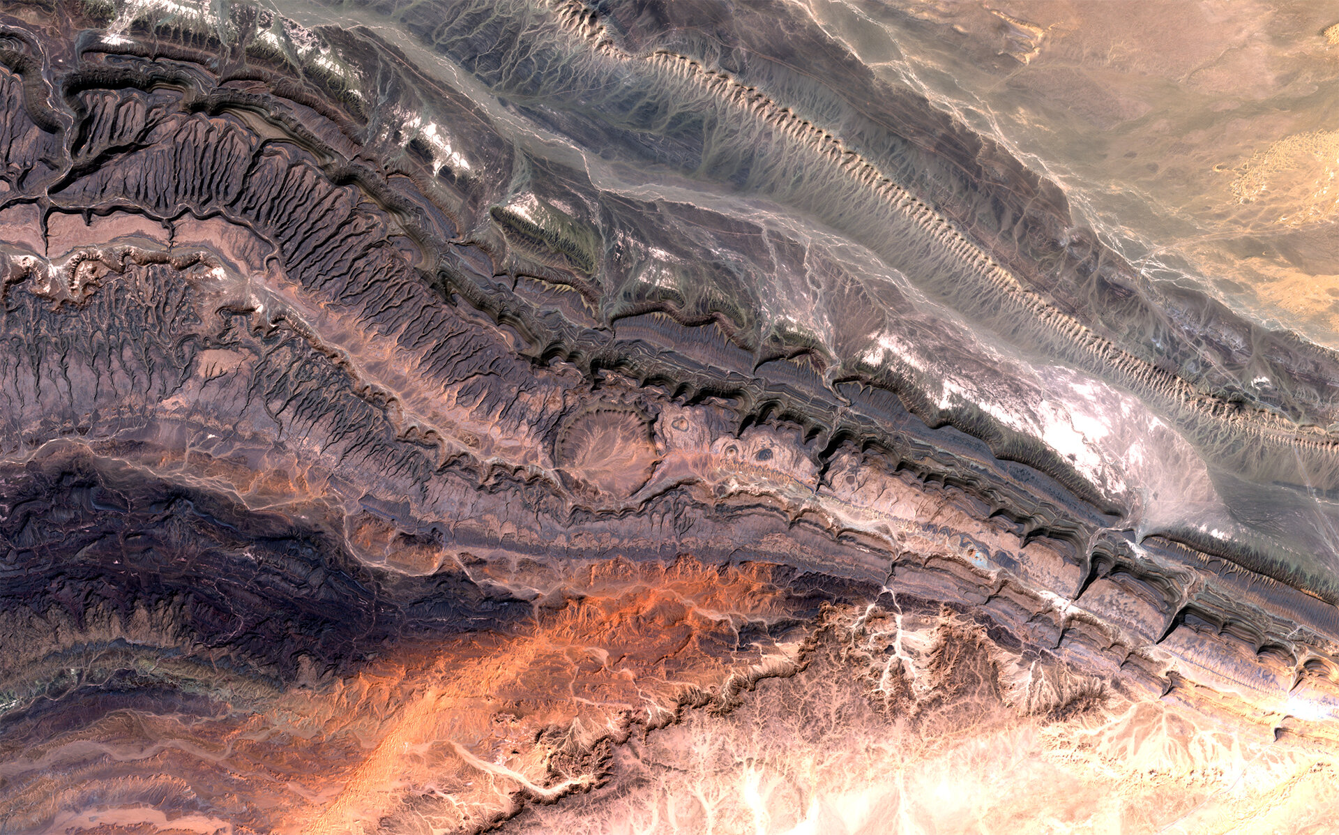
The degradation of land in dry areas due to human-related activities or climate changes is an ever-growing concern for both the local communities and affects the world as a whole. Monitoring desertification and mitigating drought must therefore be addressed at a global level. ESA has a long commitment and involvement in international environmental fora, with, for instance, the provision of Essential Climate Variables and active participation in UN Climate Change Conferences.
The World Day to Combat Desertification and Drought (17 June) is a great opportunity to recall the importance of land preservation and the work being carried by ESA to help combat these issues.

According to the UN Convention to Combat Desertification (UNCCD), land degradation affects 1.5 billion people globally and an estimated 12 million ha are lost each year due to desertification and drought. Furthermore, the spreading of extreme droughts and water scarcity contribute to mass displacements dynamics, as depicted in the on-going humanitarian crisis in Eastern Africa.
The 2030 Agenda for Sustainable Development, with its seventeen Sustainable Development Goals or SDGs, aspire to “leave no one behind”. Goal 15 – Life on Land – encourages better forest management, putting a halt to and reverse land degradation and biodiversity loss. It therefore embodies the linkage between Sustainable Land Management (SLM), integrated Natural Resources Management (NRM), food security and economic growth and resilience.
How can space help?
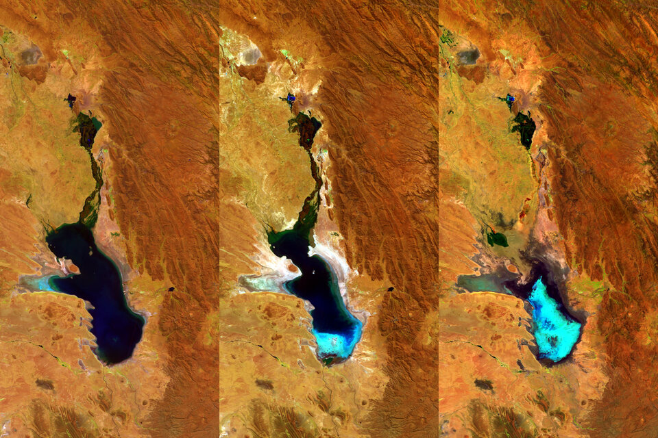
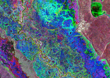
ESA has demonstrated the benefits for sustainable land management and soil and water conservation through the use of Earth Observation (EO) satellites, such as the Copernicus Sentinel satellites and Proba-V, in the form of land cover mapping and climate monitoring systems, as well as the use of remote sensing technology for a drought early warning system (SCATMALI). By providing local authorities with satellite data it is possible to mitigate some of the human-activity related effects on the environment and keep an eye on natural changes in the area.
Additionally, precision farming applications derived from data provided by both telecommunication and navigation satellites contribute to the reduced use of pesticides and better water management for fields and crops irrigation. As such, a more sustainable way of producing crops can be achieved and early warning of disease can lead to a more efficient growth.
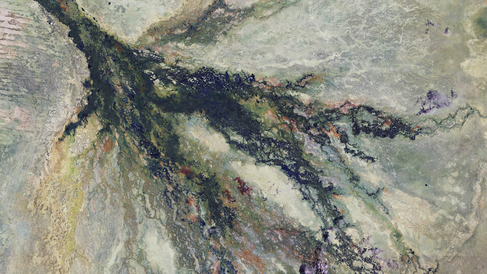
The Agency is also committed to capacity-building and transfer of know-how for the conservation and effective management of water resources and wetland ecosystems in, for instance, Africa, through the GlobWetland project. Other ESA projects also support the combatting of desertification through monitoring deforestation specifically in vulnerable areas.
The "Earth-watch" project, for example, can not only be used for disaster management but it also hosts a wide database that can be used to create multi-temporal images that highlight the changes in a specific area. This information can be used to watch changes in the past but it may also be useful to forecast the future development of an area.